|
GR®5C
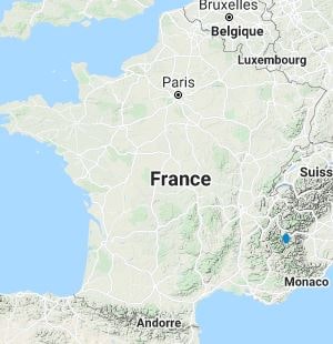
From Nevache to Briançon (Hautes-Alpes)
|

|
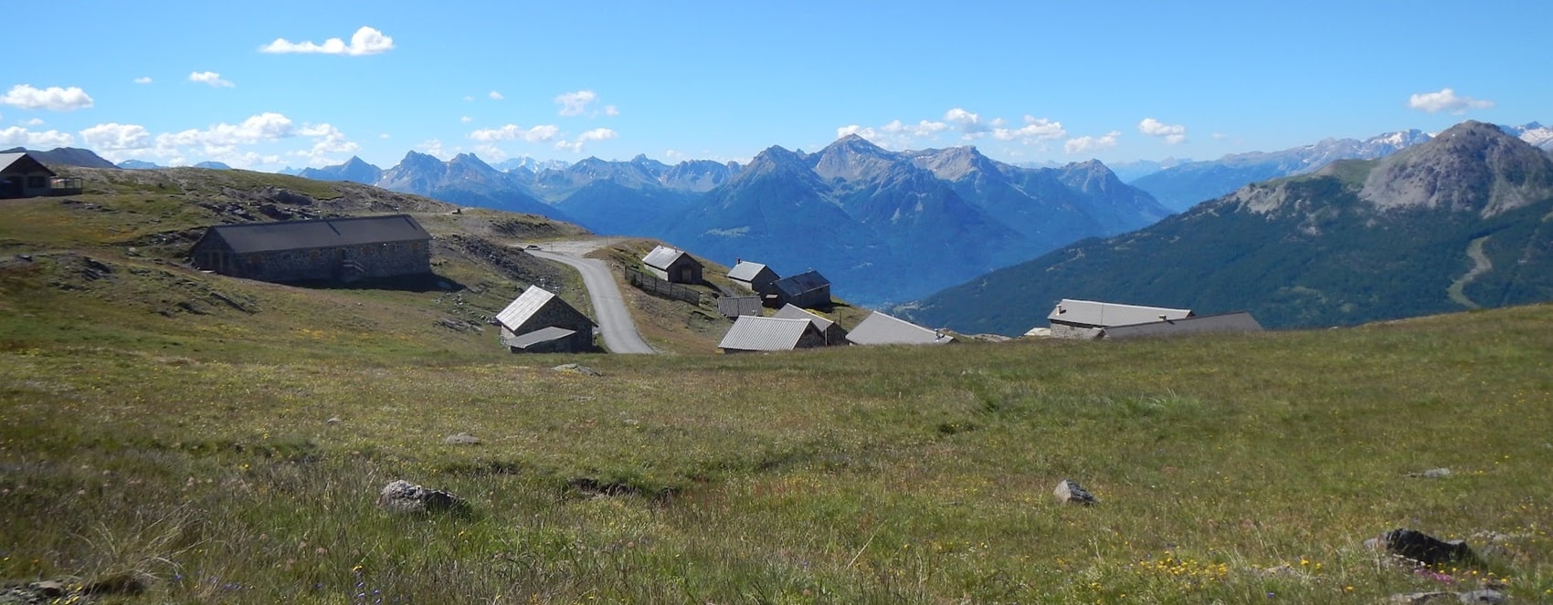
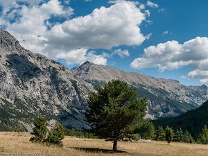
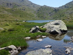
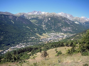
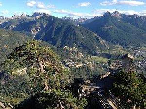
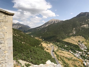
The GR®5C trail connects the unspoiled upper Clarée Valley to the historic town of Briançon, traversing the high mountain ranges of the Hautes-Alpes. The landscape is that of a high mountain range, alternating between alpine pastures, steep mountain passes, and vast forests of larch and Swiss pine, emblematic of alpine flora. Wildlife abounds, and hikers can observe eagles in flight or marmots and chamois in the highest areas. The history and heritage of this route culminate in Briançon, whose Vauban fortifications, a UNESCO World Heritage Site, bear witness to its strategic military role. The starting point, Névache, represents authentic rural heritage, with its traditional hamlets and still vibrant pastoral life, making this section a complete immersion in alpine identity.
Google Maps - Google Earth
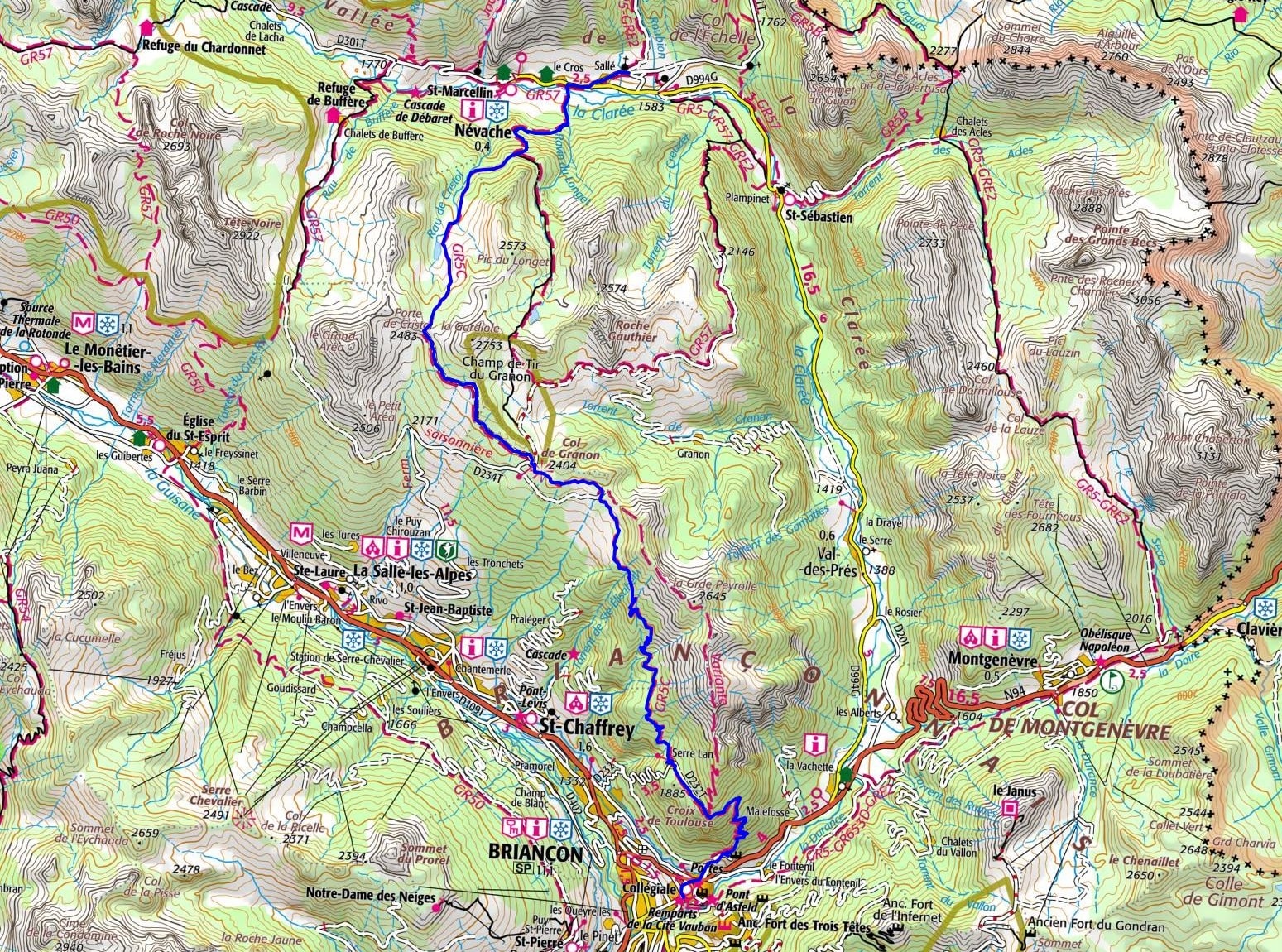
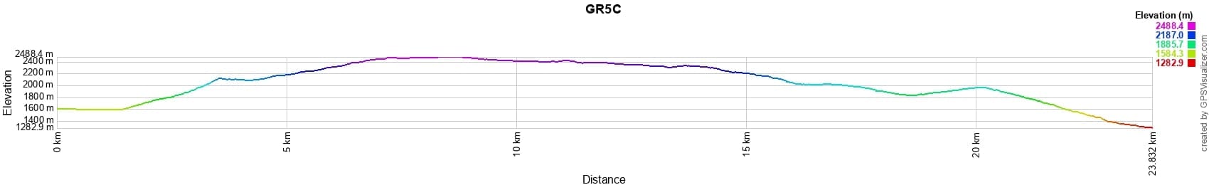

Distance: 23,81km, Elevation maximum: 2488m, Elevation minimum: 1283m, Elevation gain uphill: 1156m
IGN Maps: 3535OT - NEVACHE / MONT THABOR / COLS DU GALIBIER ET DU LAUTARET. 3536OT - BRIANCON / SERRE-CHEVALIER / MONTGENEVRE.
 Nearby paths:
GR®5 From Luxembourg to the Mediterranean
GR®5B From the Pastoral Cabin of Thures to the Oratory of Saint Roch (Hautes-Alpes)
GR®50 Around Ecrins National Park (Hautes-Alpes, Isere)
GR®54 Around Oisans and Ecrins Massifs (Isere, Hautes-Alpes)
GR®57 Around Mont Thabor (Hautes-Alpes)
GR®653D Via Domitia
 It is advisable to follow the beacons all along your hike and to bring you the FFRandonnee topo-guide. You
will also find information on MonGR.fr.
It is advisable to follow the beacons all along your hike and to bring you the FFRandonnee topo-guide. You
will also find information on MonGR.fr.
GR®, PR®, GRP®, and the corresponding signs of markings (white / red, yellow and yellow / red) are trademarks of the French
Federation of Hiking. They may not be reproduced without permission. The French Federation of Hiking, state-approved, includes organizations that create and maintain hiking routes on GR®, PR® and
GRP®. It publishes guides these topo hiking routes. With your donations, support the actions of the thousands of volunteer markers of the FFRandonnee.
GR-Infos.com is an editorial partner of MonGR.fr.

Former holiday hotel with a garden along the Allier, L'Etoile Guest House is located in La Bastide-Puylaurent between Lozere, Ardeche, and the Cevennes in the mountains of Southern France. At the crossroads of GR®7, GR®70 Stevenson Path, GR®72, GR®700 Regordane Way, GR®470 Allier River springs and gorges, GRP® Cevenol, Ardechoise Mountains, Margeride. Numerous loop trails for hiking and one-day biking excursions. Ideal for a relaxing and hiking getaway.
Copyright©gr-infos.com (Authorization for private use only)