
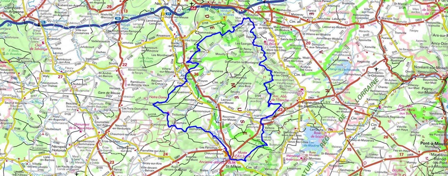
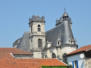
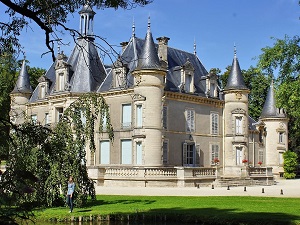
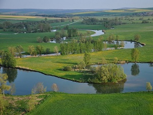
Starting in Saint-Mihiel, a town renowned for its Benedictine library and sculptures by Ligier Richier, this loop through the Meuse Heights is a journey between memory and nature. The trail climbs above the Meuse Valley towards Dompcevrin and Thillombois, whose elegant castle contrasts with the ruggedness of the surrounding forests. Following the banks of the Meuse via Tilly and Ambly, the hiker crosses mirabelle plum orchards and limestone plateaus offering sweeping views of the river's meanders. History poignantly reasserts itself as one approaches Bonzée and the Éparges ridge, a key site of the First World War. This now peaceful landscape has reclaimed its territory, providing refuge for diverse flora and fauna.
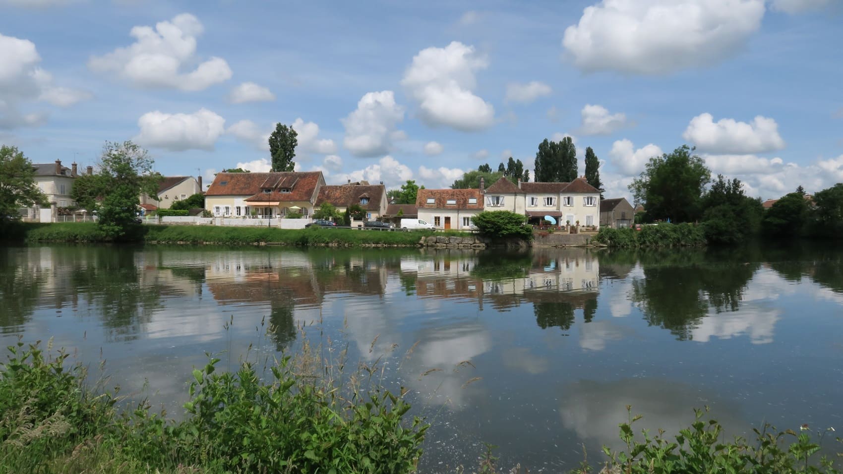
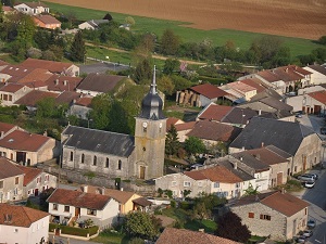
The Meuse Heights form an imposing limestone ridge overlooking the Woëvre plain, offering a natural balcony overlooking eastern France. This territory is deeply marked by history, notably by the scars of the Great War that remain in the memorial forests around Saint-Mihiel. The built heritage is remarkable, exemplified by the Renaissance works of Ligier Richier and the fortified churches that dot the wine-growing villages. As for nature, the blossoming mirabelle plum orchards transform the landscape into a sea of white each spring, while the limestone grasslands shelter rare wild orchids. The Lorraine Regional Natural Park protects these fragile environments, including the wetlands of nearby Lake Madine.
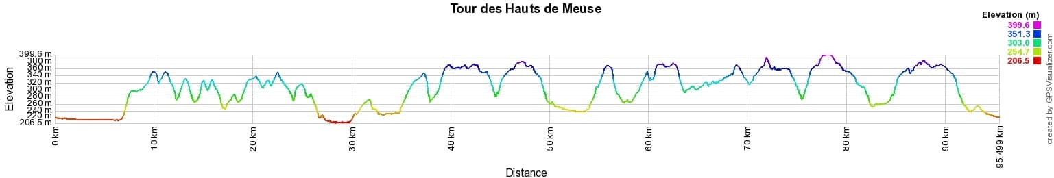
 Distance: 95km, Elevation maximum: 400m, Elevation minimum: 206m, Elevation gain uphill: 1623m
IGN Maps: 3113SB - CLERMONT-EN ARGONNE / DUGNY-SUR-MEUSE. 3114SB - PIERREFITTE-SUR-AIRE / FAINS-VEEL / VAUBECOURT. 3213SB - VIGNEULLES-LÈS-HATTONCHÂTEL / DIEUE-SUR-MEUSE. 3214SB - SAINT-MIHIEL / APREMONT-LA-FORÊT.

Nearby paths:
![]() It is advisable to follow the trail markers all along your hike and to bring the FFRandonnée topo-guide. You will also find information on MonGR.fr.
It is advisable to follow the trail markers all along your hike and to bring the FFRandonnée topo-guide. You will also find information on MonGR.fr.
GR®, PR®, GRP® and the corresponding markings are trademarks of the French Federation of Hiking. They may not be reproduced without permission. The French Federation of Hiking, state-approved, includes organizations that maintain hiking routes. It publishes guides for these routes. With your donations, support the actions of the thousands of volunteer markers of the FFRandonnée.
GR-Infos.com is an editorial partner of MonGR.fr.
| Return |

Former holiday hotel with a garden along the Allier, L'Etoile Guest House is located in La Bastide-Puylaurent between Lozere, Ardeche, and the Cevennes in the mountains of Southern France. At the crossroads of GR®7, GR®70 Stevenson Path, GR®72, GR®700 Regordane Way, GR®470 Allier River springs and gorges, GRP® Cevenol, Ardechoise Mountains, Margeride. Numerous loop trails for hiking and one-day biking excursions. Ideal for a relaxing and hiking getaway.
Copyright©gr-infos.com (Authorization for private use only)
To help us maintain and improve GR-Infos.com, a contribution of 2€ is desired via Wero or bank transfer. Thank you!