
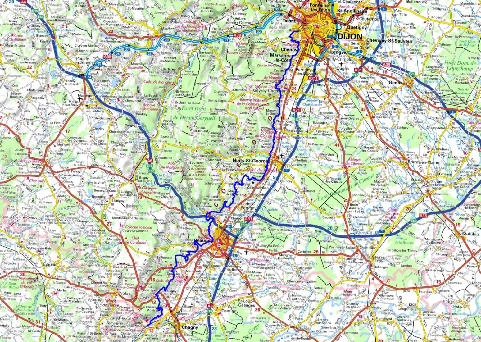
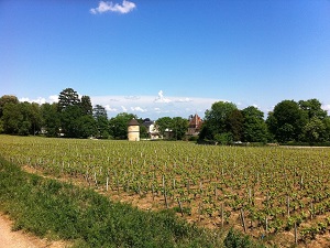
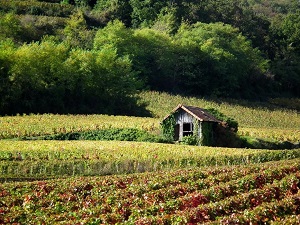
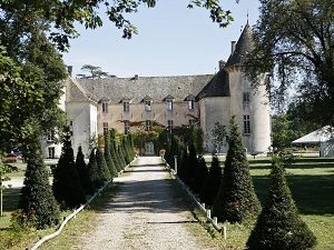
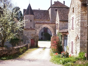
The Route des Grands Crus (Wine Route) winds through legendary villages like Gevrey-Chambertin, Vosne-Romanée, and Chassagne-Montrachet, where every plot of land tells the story of two millennia of winemaking. The built heritage is exceptional, from the Hospices de Beaune to the medieval castles overlooking the Saône plain. The trail meanders along the "Côte" (the hillside), between limestone cliffs, dry grasslands, and wooded valleys with spectacular views. Hikers discover a unique geology, that of the Burgundy climats, where the slope's exposure and the bedrock shape world-renowned wines. From Marsannay-la-Côte to the valleys of Savigny-lès-Beaune, dry stone walls (meurgers) and cabottes (small stone huts) punctuate a landscape shaped by human hands. Between Pommard and Volnay, the elegance of the bell towers and the stone estates testifies to a prosperity rooted in the land.
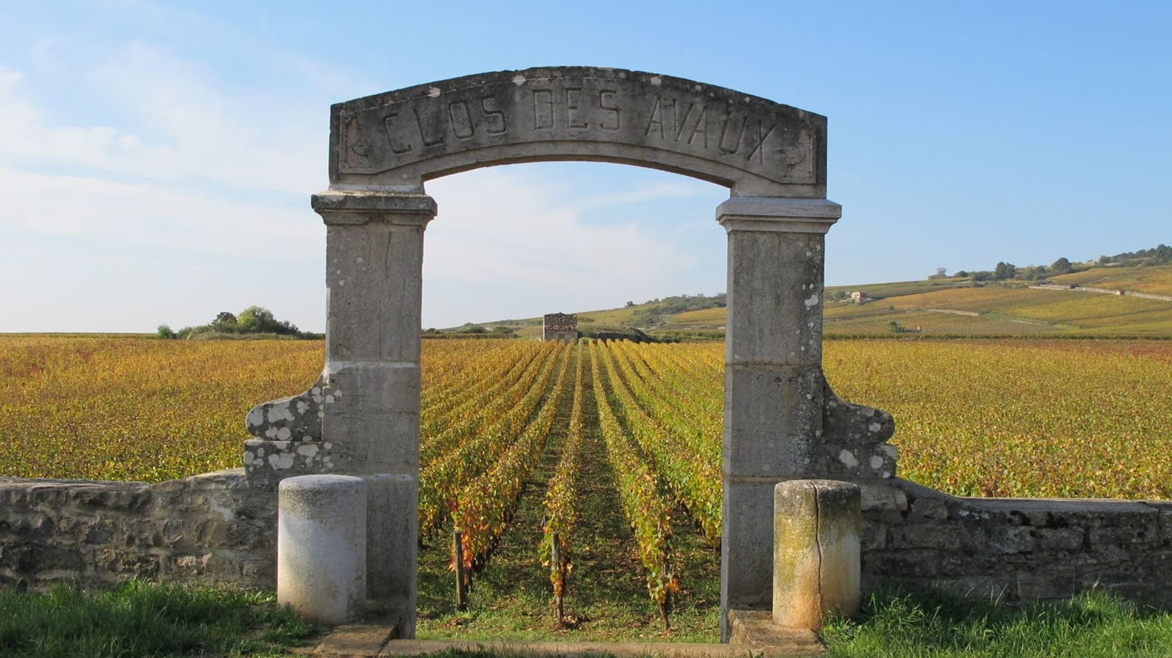
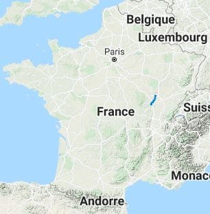
The Pays des Grands Crus is the historical and viticultural heart of Burgundy, located along the Côte de Nuits and Côte de Beaune in Côte-d'Or. This narrow strip of land, oriented eastward, is world-renowned for producing some of the most prestigious red and white wines in the world. The landscape is dominated by limestone hills adorned with meticulously tended vineyards, organized into climats (delimited plots). The Route des Grands Crus traverses legendary villages such as Gevrey-Chambertin, Vosne-Romanée, Nuits-Saint-Georges, Aloxe-Corton, and Meursault. The region's wealth lies in its medieval and religious heritage, symbolized by the Hospices de Beaune and the Chateau du Clos de Vougeot, which testify to the Cistercian viticultural history.
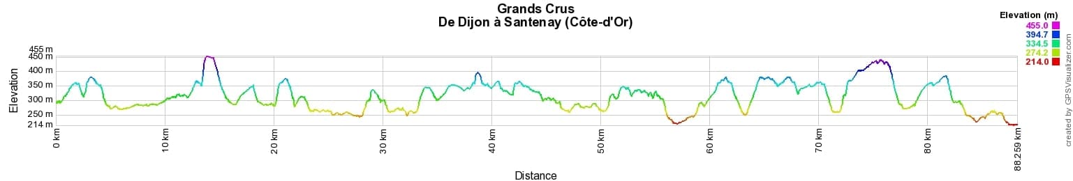
 Distance: 88km, Elevation maximum: 455m, Elevation minimum: 214m, Elevation gain uphill: 1774m
IGN Maps: 3123SB - DIJON EST / AUXONNE. 3022ET - VAL-SUZON / SAINT-SEINE-L'ABBAYE / DIJON OUEST. 3023OT - NUITS-SAINT-GEORGES. 3024OT - BEAUNE / CHAGNY. 3025SB - CHALON-SUR-SAONE (NORD) / CHAGNY.
Nearby paths:
![]() It is advisable to follow the trail markers all along your hike and to bring the FFRandonnée topo-guide. You will also find information on MonGR.fr.
It is advisable to follow the trail markers all along your hike and to bring the FFRandonnée topo-guide. You will also find information on MonGR.fr.
GR®, PR®, GRP® and the corresponding markings are trademarks of the French Federation of Hiking. They may not be reproduced without permission. The French Federation of Hiking, state-approved, includes organizations that maintain hiking routes. It publishes guides for these routes. With your donations, support the actions of the thousands of volunteer markers of the FFRandonnée.
GR-Infos.com is an editorial partner of MonGR.fr.
| Return |

Former holiday hotel with a garden along the Allier, L'Etoile Guest House is located in La Bastide-Puylaurent between Lozere, Ardeche, and the Cevennes in the mountains of Southern France. At the crossroads of GR®7, GR®70 Stevenson Path, GR®72, GR®700 Regordane Way, GR®470 Allier River springs and gorges, GRP® Cevenol, Ardechoise Mountains, Margeride. Numerous loop trails for hiking and one-day biking excursions. Ideal for a relaxing and hiking getaway.
Copyright©gr-infos.com (Authorization for private use only)
To help us maintain and improve GR-Infos.com, a contribution of 2€ is desired via Wero or bank transfer. Thank you!