
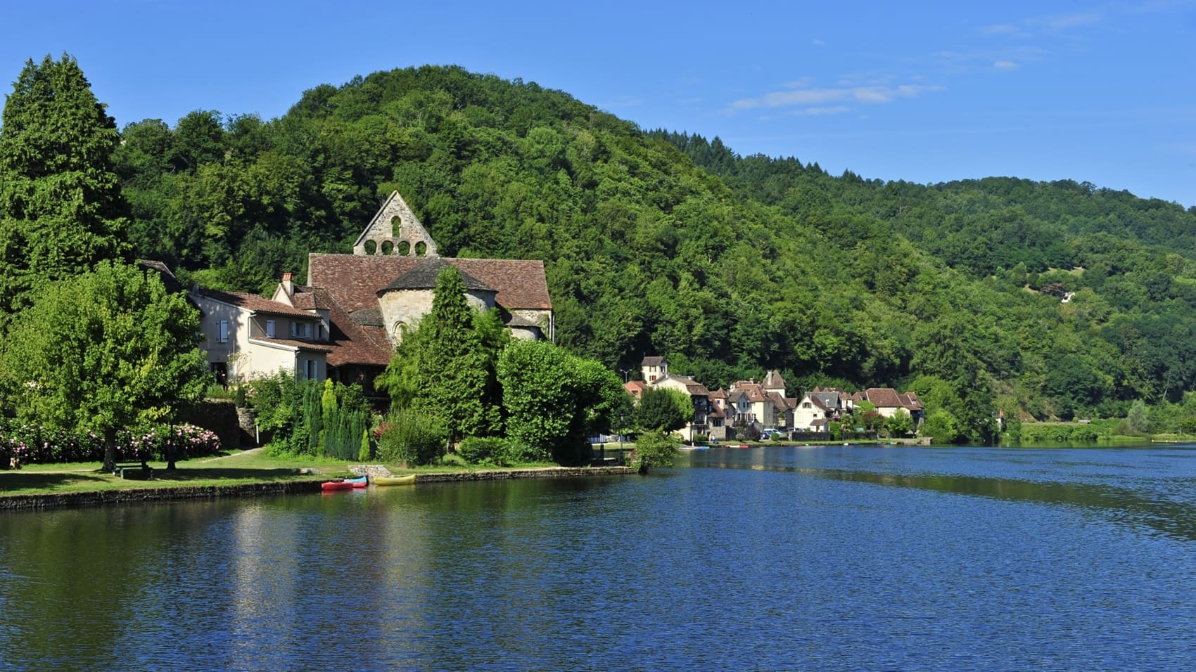
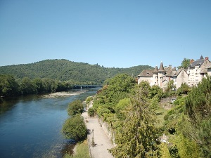
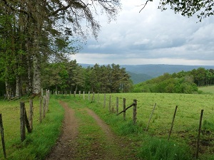
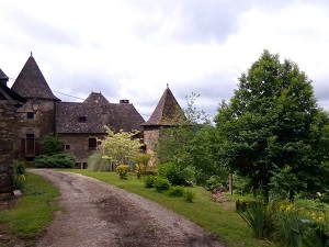
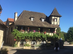
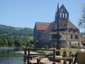
Starting in Argentat-sur-Dordogne, this riverside hike immerses walkers in the epic story of the gabariers, the former sailors who transported timber to Bordeaux. The path meanders along the banks of the Dordogne River, a UNESCO Biosphere Reserve, offering an exceptionally refreshing natural setting between oak forests and sparkling waters. Passing through Bassignac-le-Bas, you'll discover a preserved rural landscape before reaching the medieval town of Beaulieu-sur-Dordogne, nicknamed the "Limousin of the South" for its mild climate and its abbey church with a magnificent sculpted tympanum. The built heritage, characterized by river pebble houses and slate roofs, tells a story intimately linked to the river. The return journey towards Monceaux-sur-Dordogne offers breathtaking views overlooking the river's meanders, where aquatic wildlife and grey herons reign supreme.
Gabariers are people who work on gabares, which are flat-bottomed boats with sails and oars that are used for river transportation. Gabariers can be the captains of gabares, sailors, or laborers. Gabariers have played an important role in the history of river transportation. They have been used to transport goods and people on rivers throughout France, Europe, and the world. Gabariers were strong and courageous men and women. They had to be able to work hard and endure difficult conditions. They also had to be able to navigate often dangerous rivers. The use of gabares declined in the 20th century with the advent of railroads and roads.
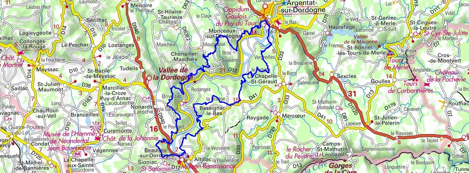
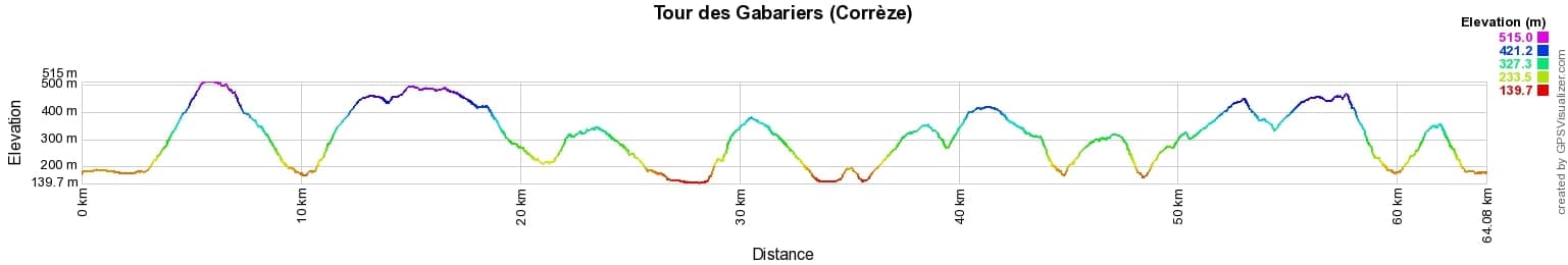
 Distance: 64km, Elevation maximum: 515m, Elevation minimum: 140m, Elevation gain uphill: 2281m
IGN Maps: 2235SB - ARGENTAT-SUR-DORDOGNE / SAINT-PRIVAT / BARRAGE DU CHASTANG. 2136ET - ROCAMADOUR / PADIRAC. 2236SB - SAINT-CÉRÉ / SOUSCEYRAC.

Nearby paths:
![]() It is advisable to follow the trail markers all along your hike and to bring the FFRandonnée topo-guide. You will also find information on MonGR.fr.
It is advisable to follow the trail markers all along your hike and to bring the FFRandonnée topo-guide. You will also find information on MonGR.fr.
GR®, PR®, GRP® and the corresponding markings are trademarks of the French Federation of Hiking. They may not be reproduced without permission. The French Federation of Hiking, state-approved, includes organizations that maintain hiking routes. It publishes guides for these routes. With your donations, support the actions of the thousands of volunteer markers of the FFRandonnée.
GR-Infos.com is an editorial partner of MonGR.fr.
| Return |

Former holiday hotel with a garden along the Allier, L'Etoile Guest House is located in La Bastide-Puylaurent between Lozere, Ardeche, and the Cevennes in the mountains of Southern France. At the crossroads of GR®7, GR®70 Stevenson Path, GR®72, GR®700 Regordane Way, GR®470 Allier River springs and gorges, GRP® Cevenol, Ardechoise Mountains, Margeride. Numerous loop trails for hiking and one-day biking excursions. Ideal for a relaxing and hiking getaway.
Copyright©gr-infos.com (Authorization for private use only)
To help us maintain and improve GR-Infos.com, a contribution of 2€ is desired via Wero or bank transfer. Thank you!