
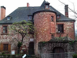
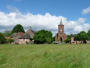
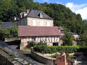
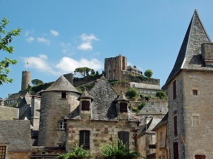
Starting in Meyssac, the trail winds between Lagleygeolle and Lostanges, offering sweeping views of the verdant hills of the Corrèze region before descending towards Curemonte, a medieval village with three castles and three churches. The heritage continues in Branceilles, famous for its "Thousand and One Stones" vineyard, and then in Saillac with its remarkable Romanesque church. Feudal history reaches its zenith in Turenne, a former sovereign viscounty whose proud silhouette dominates the horizon from its rocky spur. Nature is bountiful here, blending walnut orchards and vineyards on the sunny slopes of Chauffour-sur-Vell. Passing through Noailhac, the hiker approaches the visual highlight of the route: Collonges-la-Rouge, a ruby jewel built entirely of purple sandstone.
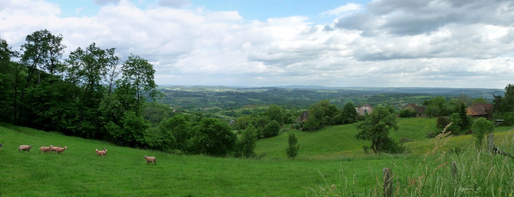
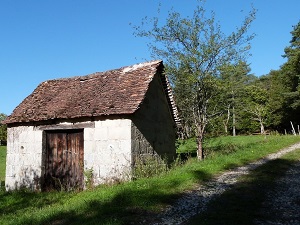
The Midi Corrézien is a warm and sunny region located in the south of the department, marking a dramatic transition from the Millevaches plateau. The landscape is characterized by fertile limestone hills, valleys carved by the Dordogne and Vézère rivers, and the omnipresence of red sandstone, visible in the buildings. Its history is rich, with a strong medieval influence, as evidenced by the fortified villages, and a tradition linked to the barges that once plied the Dordogne. The flora benefits from the southern influence, resulting in forests of chestnut, oak, and walnut trees, while the fauna is typical of the bocage countryside of southwestern France. This region offers a unique blend of the ruggedness of the Limousin and the gentleness of the Quercy.
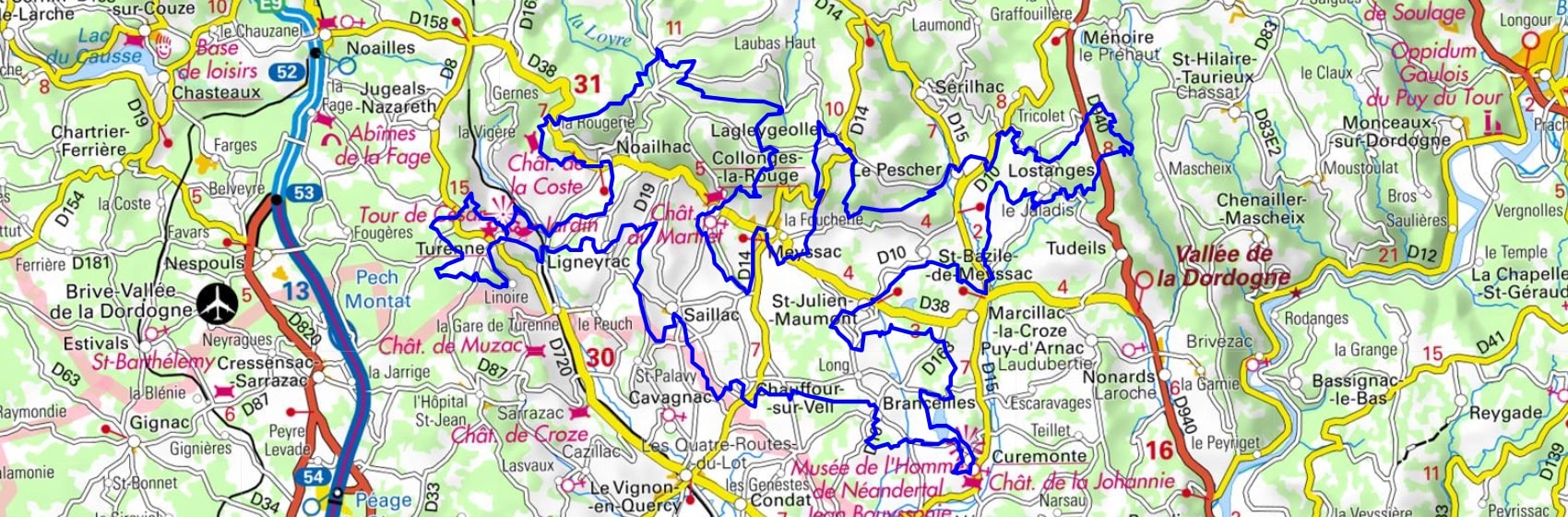
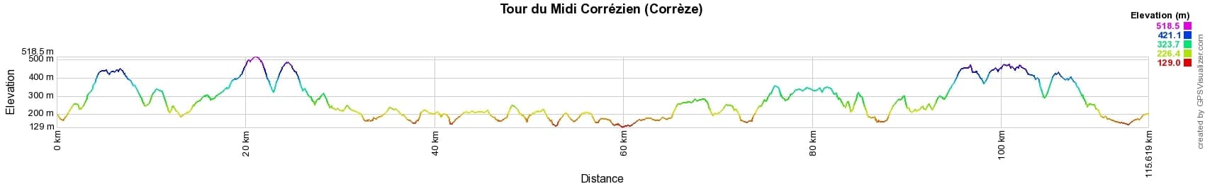
 Distance: 116km, Elevation maximum: 518m, Elevation minimum: 129m, Elevation gain uphill: 2990m
IGN Maps: 2135SB - BRIVE-LA-GAILLARDE / COLLONGES-LA-ROUGE / BEYNAT. 2136ET - ROCAMADOUR / PADIRAC. 2235SB - ARGENTAT-SUR-DORDOGNE / SAINT-PRIVAT / BARRAGE DU CHASTANG.

Nearby paths:
![]() It is advisable to follow the beacons all along your hike and to bring the FFRandonnée topo-guide. You will also find information on MonGR.fr.
It is advisable to follow the beacons all along your hike and to bring the FFRandonnée topo-guide. You will also find information on MonGR.fr.
GR®, PR®, GRP® and the corresponding markings are trademarks of the French Federation of Hiking. They may not be reproduced without permission. The French Federation of Hiking, state-approved, includes organizations that maintain hiking routes. It publishes guides for these routes. With your donations, support the actions of the thousands of volunteer markers of the FFRandonnée.
GR-Infos.com is an editorial partner of MonGR.fr.
| Return |

Former holiday hotel with a garden along the Allier, L'Etoile Guest House is located in La Bastide-Puylaurent between Lozere, Ardeche, and the Cevennes in the mountains of Southern France. At the crossroads of GR®7, GR®70 Stevenson Path, GR®72, GR®700 Regordane Way, GR®470 Allier River springs and gorges, GRP® Cevenol, Ardechoise Mountains, Margeride. Numerous loop trails for hiking and one-day biking excursions. Ideal for a relaxing and hiking getaway.
Copyright©gr-infos.com (Authorization for private use only)
To help us maintain and improve GR-Infos.com, a contribution of 2€ is desired via Wero or bank transfer. Thank you!