
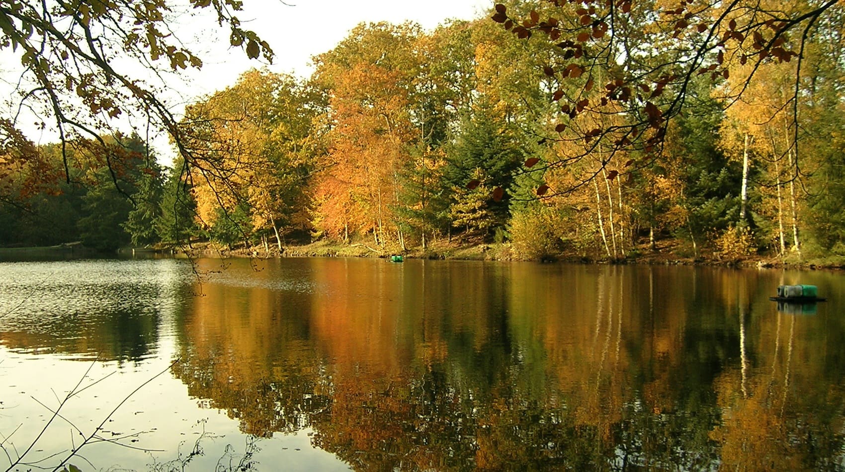
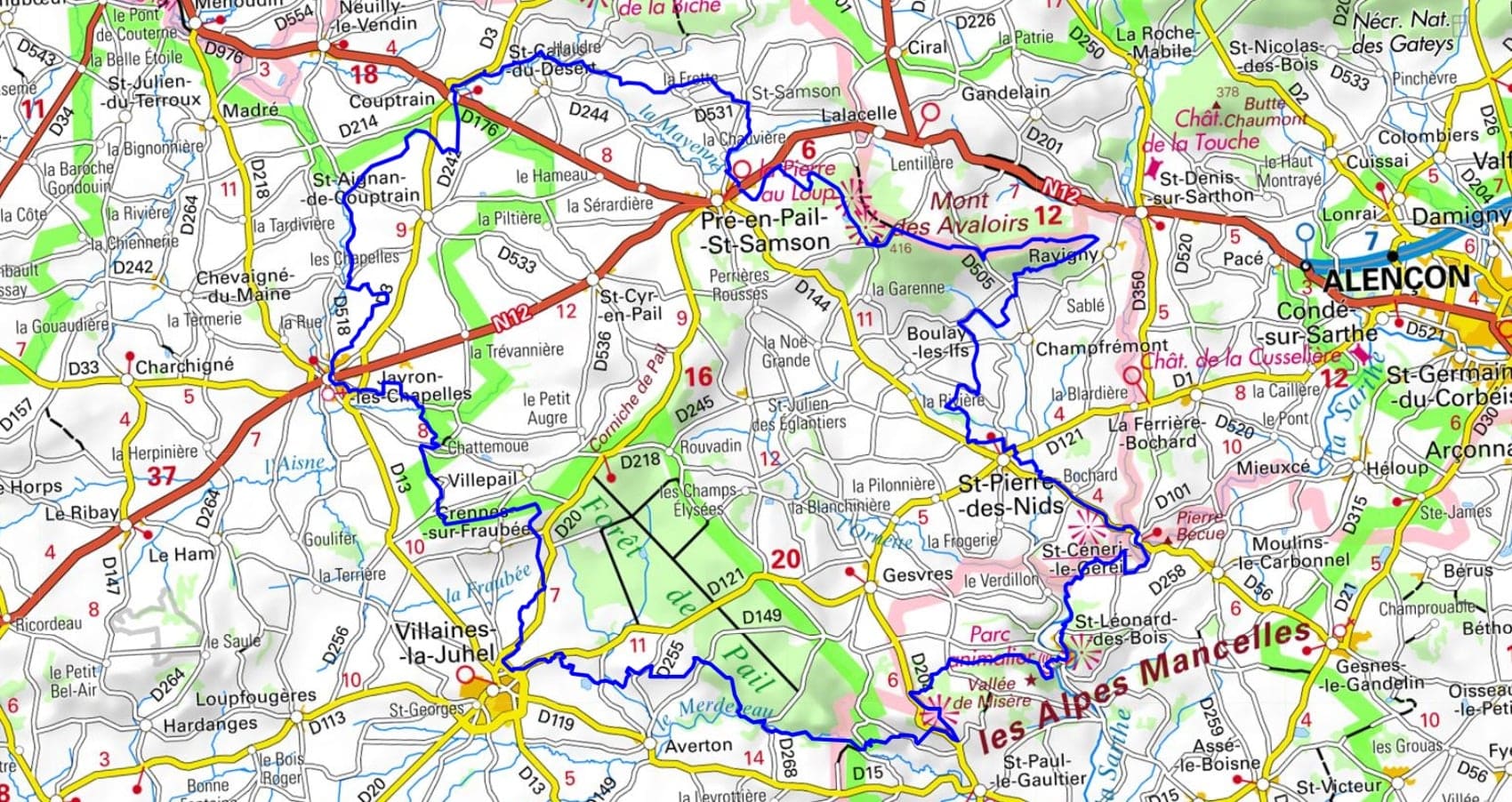
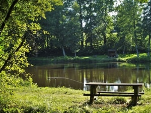
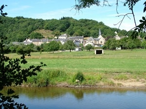
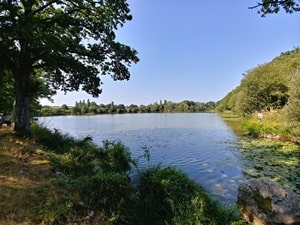
Starting from Pré-en-Pail-Saint-Samson, the trail begins with an ascent of Mont des Avaloirs, the highest peak in the Armorican Massif. The path then winds through expansive forests and heathland towards Saint-Pierre-des-Nids, serving as a gateway to the Alpes Mancelles. Along the way, hikers encounter Saint-Céneri-le-Gérei, nestled gracefully in a bend of the Sarthe River and celebrated as one of the most beautiful villages in France. Following the river's dramatic gorges, the route unveils the rugged and untamed landscapes of Saint-Léonard-des-Bois, leading onward to Villaines-la-Juhel, a town steeped in the historic tradition of hemp cultivation. Continuing through the rural charm of Javron-les-Chapelles, the trail highlights the poetic beauty of the Mayenne bocage. The path meanders gently between apple orchards and historic sunken lanes before climbing towards Couptrain, where it traverses a rolling landscape of lush pastures and vital wetlands. This complete loop, sitting at the crossroads of the Mayenne, Orne, and Sarthe departments, offers a striking and continuous contrast of varied landscapes.
Located in the heart of the Normandy-Maine Regional Natural Park, Mont des Avaloirs stands proudly as the highest point of the Armorican Massif and the entirety of western France, reaching an altitude of 416 meters. Situated at the natural confluence of the Mayenne, Orne, and Sarthe rivers, this protected site offers an exceptional, sweeping panorama that—on a clear day—extends all the way to Mont-Saint-Michel. A modern observation deck, recognized as a true architectural marvel, overlooks a vast mosaic of landscapes where open heathland, fragile peat bogs, and dense deciduous forests beautifully alternate. The mount's history is notably marked by its strategic role as an observation post, famously used by early surveyors to map out the nation of France. Today, this vital biodiversity sanctuary shelters a variety of rare flora, serving as a resilient testament to the historically harsh Armorican climate.
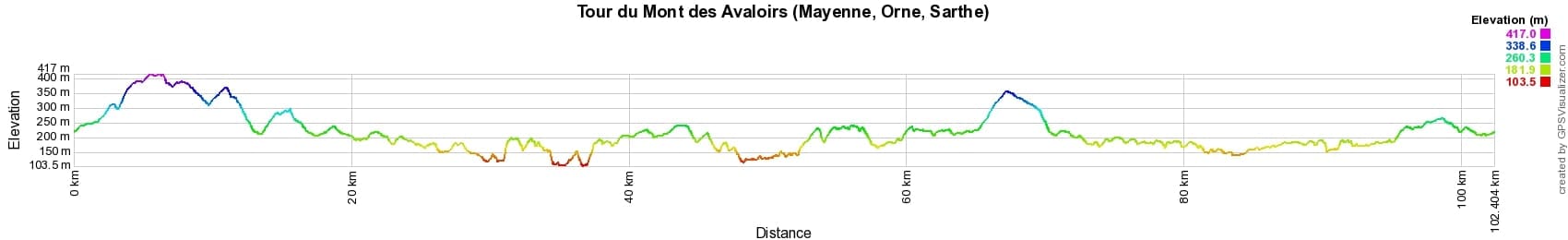
 Distance: 101km, Elevation maximum: 415m, Elevation minimum: 105m, Elevation gain uphill: 1667m
IGN Maps: 1616SB - LA FERTÉ-MACÉ PRÉ-EN-PAIL CARROUGES. 1617SB - VILLAINES-LA-JUHEL SAINT-PIERRE-DES-NIDS ALPES MANCELLES.
Nearby paths:
![]() It is advisable to follow the beacons all along your hike and to bring the FFRandonnée topo-guide. You will also find information on MonGR.fr.
It is advisable to follow the beacons all along your hike and to bring the FFRandonnée topo-guide. You will also find information on MonGR.fr.
GR®, PR®, GRP® and the corresponding markings are trademarks of the French Federation of Hiking. They may not be reproduced without permission. The French Federation of Hiking, state-approved, includes organizations that maintain hiking routes. It publishes guides for these routes. With your donations, support the actions of the thousands of volunteer markers of the FFRandonnée.
GR-Infos.com is an editorial partner of MonGR.fr.
| Return |

Former holiday hotel with a garden along the Allier, L'Etoile Guest House is located in La Bastide-Puylaurent between Lozere, Ardeche, and the Cevennes in the mountains of Southern France. At the crossroads of GR®7, GR®70 Stevenson Path, GR®72, GR®700 Regordane Way, GR®470 Allier River springs and gorges, GRP® Cevenol, Ardechoise Mountains, Margeride. Numerous loop trails for hiking and one-day biking excursions. Ideal for a relaxing and hiking getaway.
Copyright©gr-infos.com (Authorization for private use only)
To help us maintain and improve GR-Infos.com, a contribution of 2€ is desired via Wero or bank transfer. Thank you!