
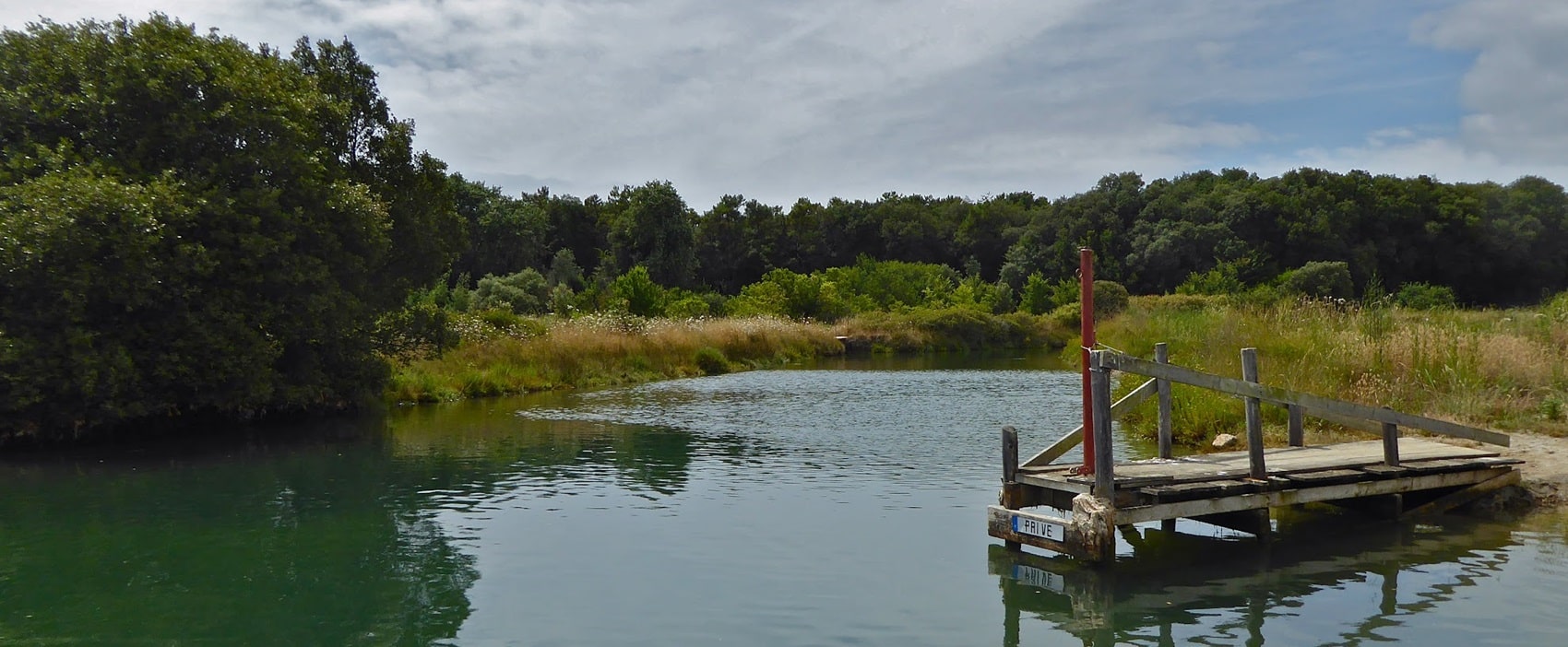
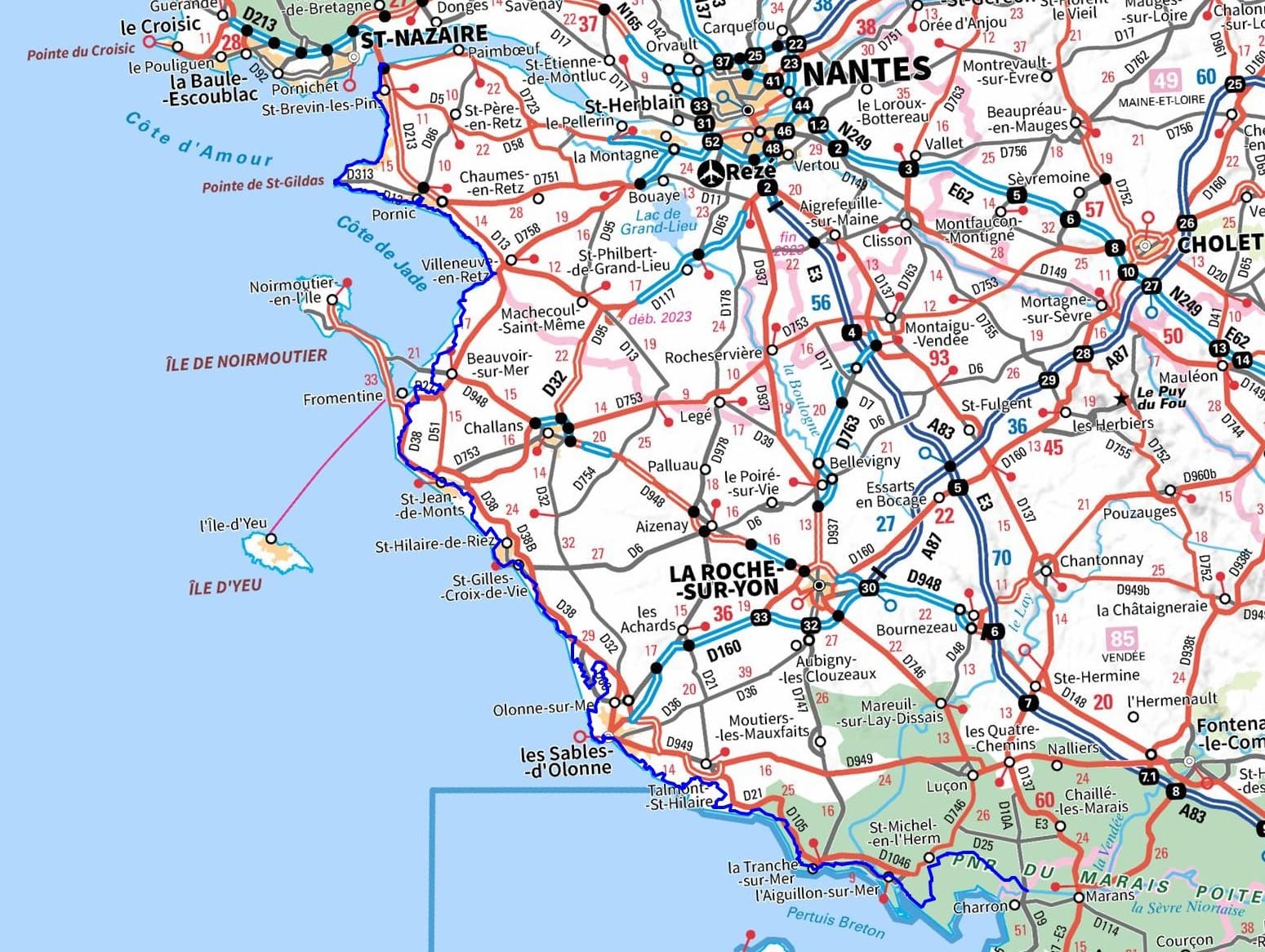
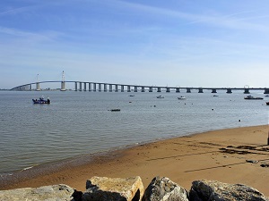
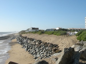
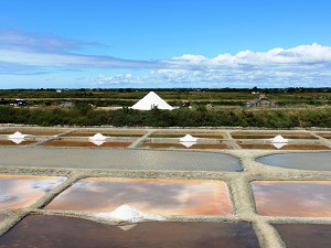
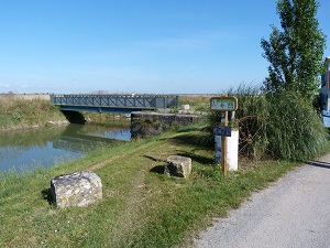
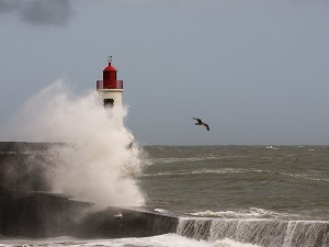
The GR®8 runs along the Jade Coast, passing by the iconic fisheries of Saint-Michel-Chef-Chef and the cliffs of Préfailles, before reaching the old port of Pornic. Crossing La Bernerie and Les Moutiers-en-Retz, hikers discover an ancestral salt-making heritage, followed by the vastness of the Vendée Breton Marsh towards Beauvoir-sur-Mer. The coastline then transforms into a ribbon of golden sand and national forests in Saint-Jean-de-Monts and Saint-Hilaire-de-Riez, where the wild nature of the dunes is protected. After the jagged coasts of Bretignolles and the vineyards of Brem-sur-Mer, the arrival at Les Sables-d'Olonne reveals the prestigious history of offshore navigation. The trail continues south, between the marinas of Jard-sur-Mer and the surfing spots of La Tranche-sur-Mer with its oyster farms, then the polders of Saint-Michel-en-l'Herm, to reach the Brault locks in Charron. The mouth of the Loire marks a masterly transition where Europe's last wild river merges into the Atlantic, shaping the contours of a Jade Coast with shale coves and traditional fisheries. Heading south, the Pointe de Saint-Gildas raises its sandstone cliffs, a geological sentinel offering a unique panorama over the estuary and the remains of World War II blockhouses. The journey continues along the Bay of Bourgneuf, a former hub for the "white gold" trade, where salt marshes tell of medieval prosperity linked to salt exports to Northern Europe. Here begins the Breton Marsh, a vast mosaic of polders and channels where biodiversity thrives between land and sea, sheltering thousands of migratory birds. Further south, the Marais Poitevin Regional Natural Park, nicknamed the "Green Venice," reveals an exceptional hydraulic heritage shaped by monks since the Middle Ages. This labyrinth of canals shaded by pollard ash trees forms a fragile ecosystem, a true vegetable cathedral where the silence is broken only by the gliding of boats. Between the oyster ports of the bay and the serenity of the wetlands, this coastal fringe bears witness to a centuries-old human struggle to tame the waters.
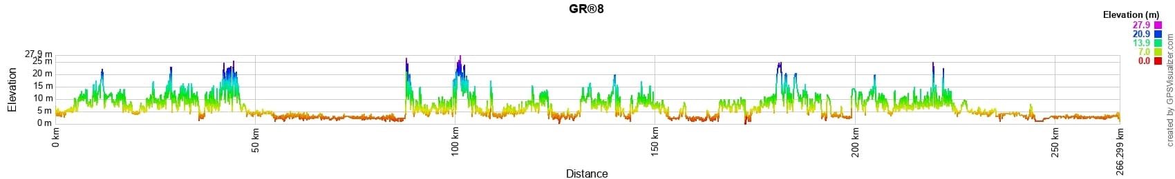
 Distance: 255km, Elevation maximum: 26m, Elevation minimum: 1m, Elevation gain uphill: 393m

Nearby paths:
![]() It is advisable to follow the beacons all along your hike and to bring the FFRandonnée topo-guide. You will also find information on MonGR.fr.
It is advisable to follow the beacons all along your hike and to bring the FFRandonnée topo-guide. You will also find information on MonGR.fr.
GR®, PR®, GRP®, and the corresponding signs of markings (white/red, yellow and yellow/red) are trademarks of the French Federation of Hiking. They may not be reproduced without permission. The French Federation of Hiking, state-approved, includes organizations that create and maintain hiking routes on GR®, PR® and GRP®. It publishes topo-guides for these hiking routes. With your donations, support the actions of the thousands of volunteer markers of the FFRandonnée.
GR-Infos.com is an editorial partner of MonGR.fr.
| Return |

Former holiday hotel with a garden along the Allier, L'Etoile Guest House is located in La Bastide-Puylaurent between Lozere, Ardeche, and the Cevennes in the mountains of Southern France. At the crossroads of GR®7, GR®70 Stevenson Path, GR®72, GR®700 Regordane Way, GR®470 Allier River springs and gorges, GRP® Cevenol, Ardechoise Mountains, Margeride. Numerous loop trails for hiking and one-day biking excursions. Ideal for a relaxing and hiking getaway.
Copyright©gr-infos.com (Authorization for private use only)
To help us maintain and improve GR-Infos.com, a contribution of 2€ is desired via Wero or bank transfer. Thank you!