
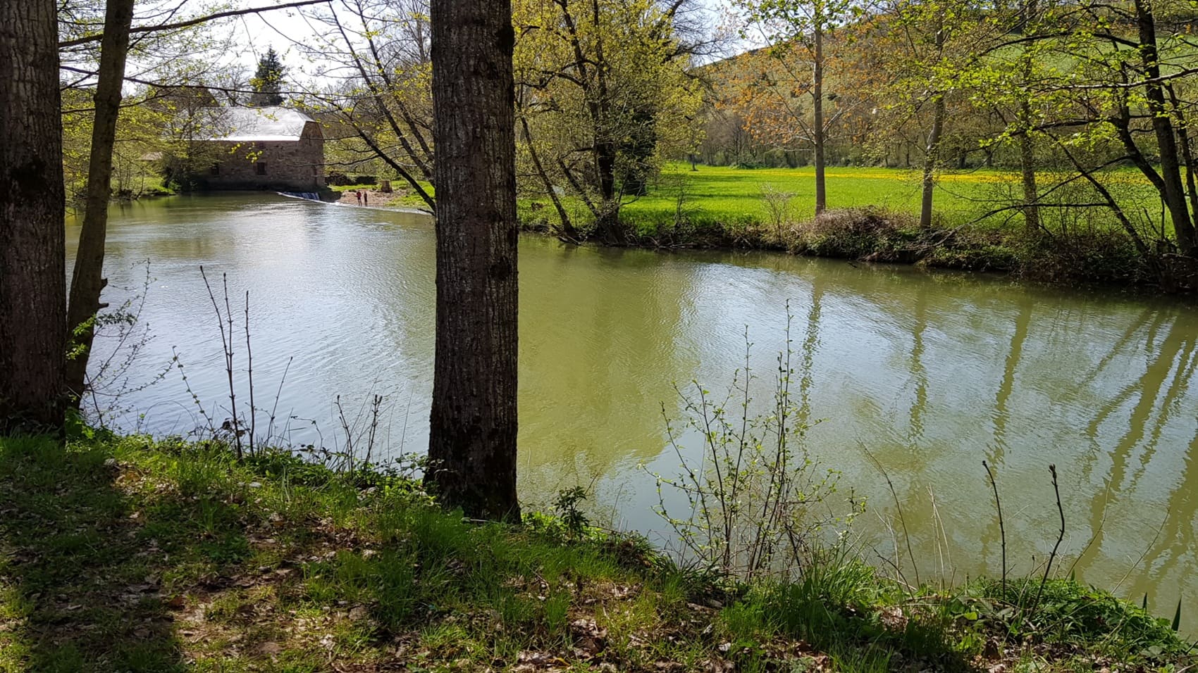
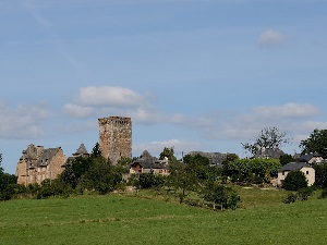
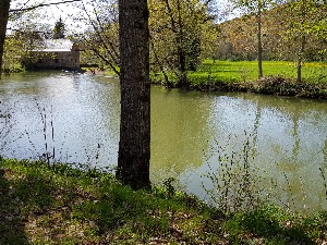
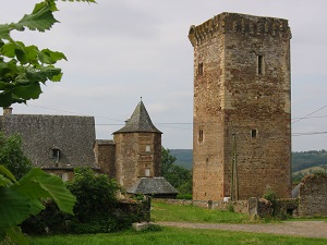
The GR620 begins in the Lot Valley and climbs towards the vast expanses of the Causse Comtal plateau. The trail winds through a land of passage and faith, intersecting the routes of the Camino de Santiago and linking ancient medieval lordships. The architectural heritage is abundant: from twisted spires (shaped like flames) to robust Romanesque churches, each village along the way tells a story of stone and resilience. The path offers a fascinating transition between the gentle banks of the Lot River and the stark limestone of the plateau. The landscapes are composed of "clapas" (piles of stones), fertile sinkholes, and pastures dotted with traditional cazelles (small stone huts). Hikers traverse an ecosystem of dry grasslands, a haven for wild orchids and birds of prey such as the short-toed eagle. The approach to Inières reveals an imposing fortified church, a symbol of the protection afforded to rural populations in centuries past.
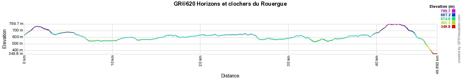

 Distance: 46.87km, Elevation maximum: 801m, Elevation minimum: 350m, Elevation gain uphill: 1082m
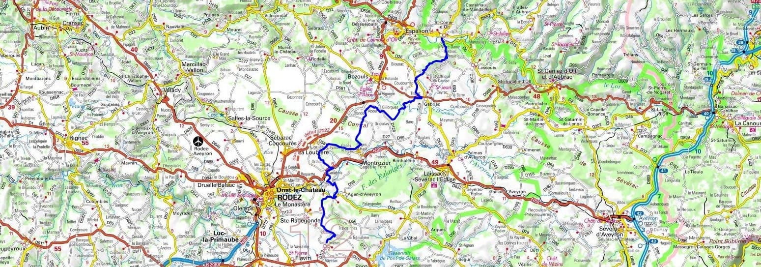
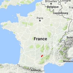
IGN Maps: Espalion (2438E). Laissac (2439E). Rodez (2439O).
Nearby paths:
![]() It is advisable to follow the beacons throughout your itinerary and to take the Fédération Française de la Randonnée Pédestre topo-guide with you. You will also find information on MonGR.fr.
It is advisable to follow the beacons throughout your itinerary and to take the Fédération Française de la Randonnée Pédestre topo-guide with you. You will also find information on MonGR.fr.
GR®, PR®, GRP®, and the corresponding signs of markings (white / red, yellow and yellow / red) are trademarks of the French Federation of Hiking. They may not be reproduced without permission. The French Federation of Hiking, state-approved, includes organizations that create and maintain hiking routes on GR®, PR®, and GRP®. It publishes guides for these topo hiking routes. With your donations, you support the actions of the thousands of FFRandonnée volunteer markers.
GR-Infos.com is an editorial partner of MonGR.fr.
| Return |

Former holiday hotel with a garden along the Allier, L'Etoile Guest House is located in La Bastide-Puylaurent between Lozere, Ardeche, and the Cevennes in the mountains of Southern France. At the crossroads of GR®7, GR®70 Stevenson Path, GR®72, GR®700 Regordane Way, GR®470 Allier River springs and gorges, GRP® Cevenol, Ardechoise Mountains, Margeride. Numerous loop trails for hiking and one-day biking excursions. Ideal for a relaxing and hiking getaway.
Copyright©gr-infos.com (Authorization for private use only)
To help us maintain and improve GR-Infos.com, a contribution of 2€ is desired via Wero or bank transfer. Thank you!