
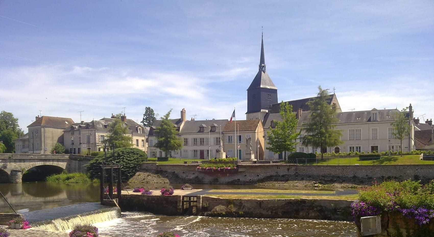
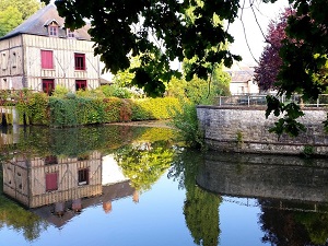
Starting in Loir-et-Cher, the route passes through Bracieux, a charming town famous for its 16th-century market hall, before heading towards Courmemin past shimmering ponds. The trail winds between stone pines and heather, revealing a wild landscape where deer and herons reign supreme over these historic hunting lands. Reaching Romorantin-Lanthenay, the capital of Sologne, hikers will discover an elegant urban heritage marked by the influence of Leonardo da Vinci and the banks of the Sauldre. Local architecture is showcased through half-timbered houses and typical red bricks, serving as witnesses to centuries of craftsmanship. The journey ends in Villefranche-sur-Cher, offering a gentle transition to the more open landscapes of the Cher Valley.
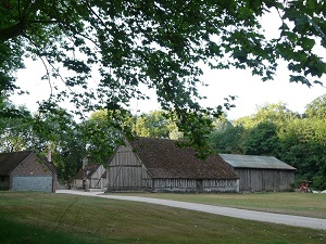
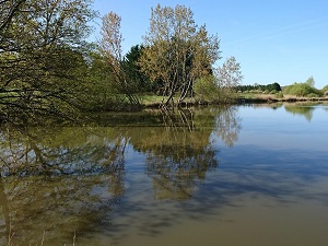
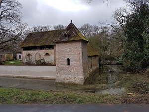
The Sologne region, nestled between the royal meanders of the Loire and the peaceful waters of the Cher, is a land of mystery, ponds, and deep forests. This wild 500,000-hectare area, once marshy and unhealthy, was transformed under Napoleon III, shaping today's landscape of moorlands and pine forests. The built heritage is unique, characterized by red brick houses and elegant half-timbering found in La Ferté-Imbault or Chaumont-sur-Tharonne. At the heart of this lush greenery stands the Renaissance jewel, the Château de Chambord, whose immense walled forest estate preserves exceptional wildlife, notably deer and wild boar. Nature thrives here through more than 3,000 ponds, true sanctuaries for migratory birds and aquatic flora. As you head towards the Cher Valley, the terrain ripples, giving way to renowned vineyards and medieval towns like Mennetou-sur-Cher. The history of Sologne is inseparable from hunting and fishing, ancient traditions that still permeate the local lifestyle and gastronomy. Between the banks of the Loire and the hillsides of the Cher, this territory offers a timeless escape, where the silence of the woods is only broken by the belling of the deer in autumn.
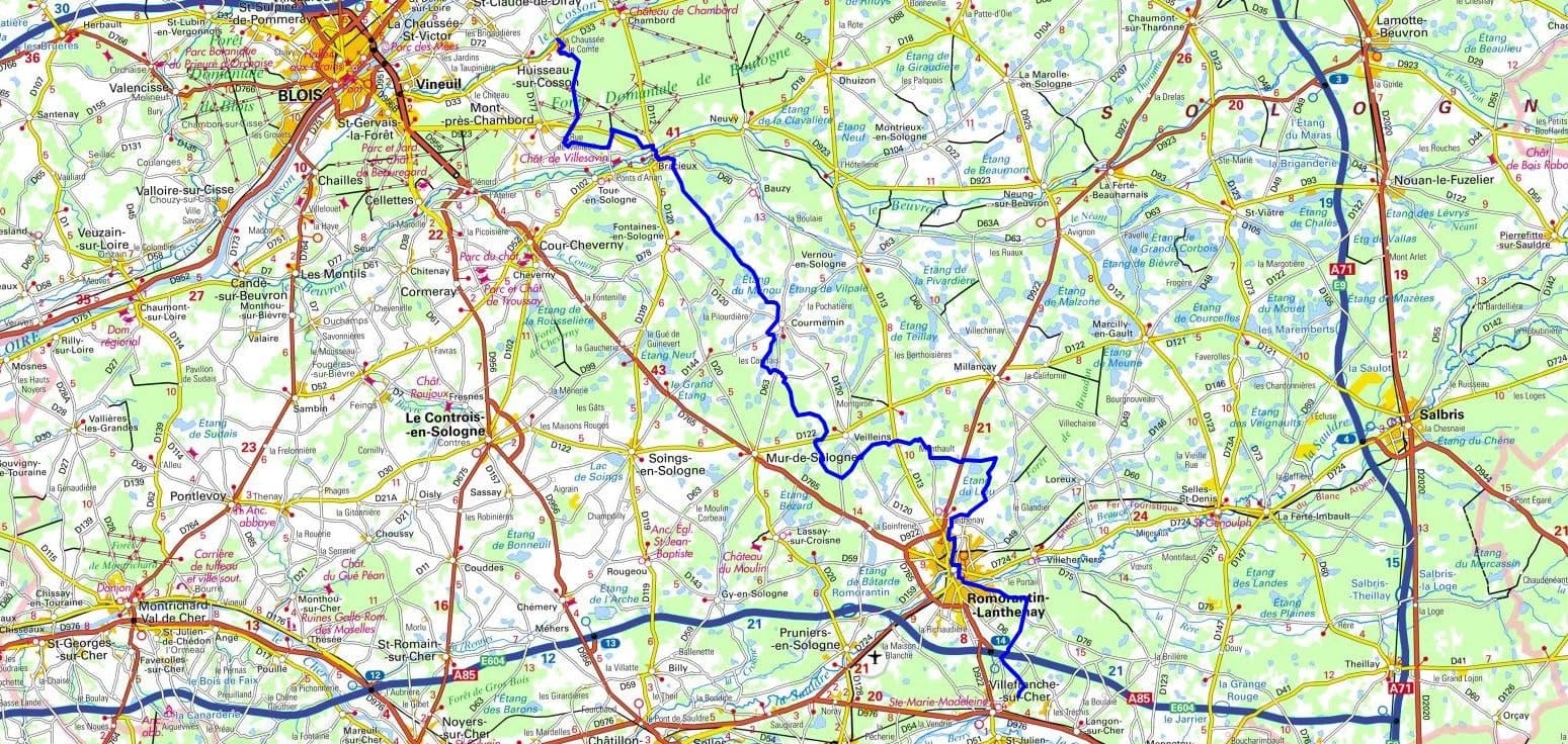
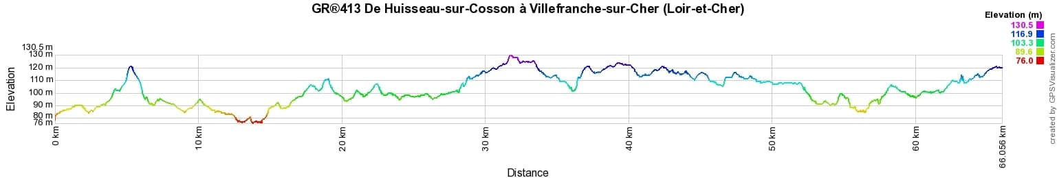
 Distance: 66km, Maximum altitude: 129m, Minimum altitude: 76m, Total ascent: 181m
Nearby trails:
![]() It is advisable to follow the beacons throughout your hike and to bring the FFRandonnée topo-guide. You will also find information on MonGR.fr.
It is advisable to follow the beacons throughout your hike and to bring the FFRandonnée topo-guide. You will also find information on MonGR.fr.
GR®, PR®, GRP®, and the corresponding signs of markings (white / red, yellow and yellow / red) are trademarks of the French Federation of Hiking. They may not be reproduced without permission. The French Federation of Hiking, state-approved, includes organizations that create and maintain hiking routes on GR®, PR®, and GRP®. It publishes guides for these topo hiking routes. With your donations, you support the actions of the thousands of FFRandonnée volunteer markers.
GR-Infos.com is an editorial partner of MonGR.fr.
| Return |

Former holiday hotel with a garden along the Allier, L'Etoile Guest House is located in La Bastide-Puylaurent between Lozere, Ardeche, and the Cevennes in the mountains of Southern France. At the crossroads of GR®7, GR®70 Stevenson Path, GR®72, GR®700 Regordane Way, GR®470 Allier River springs and gorges, GRP® Cevenol, Ardechoise Mountains, Margeride. Numerous loop trails for hiking and one-day biking excursions. Ideal for a relaxing and hiking getaway.
Copyright©gr-infos.com (Authorization for private use only)
To help us maintain and improve GR-Infos.com, a contribution of 2€ is desired via Wero or bank transfer. Thank you!