
|
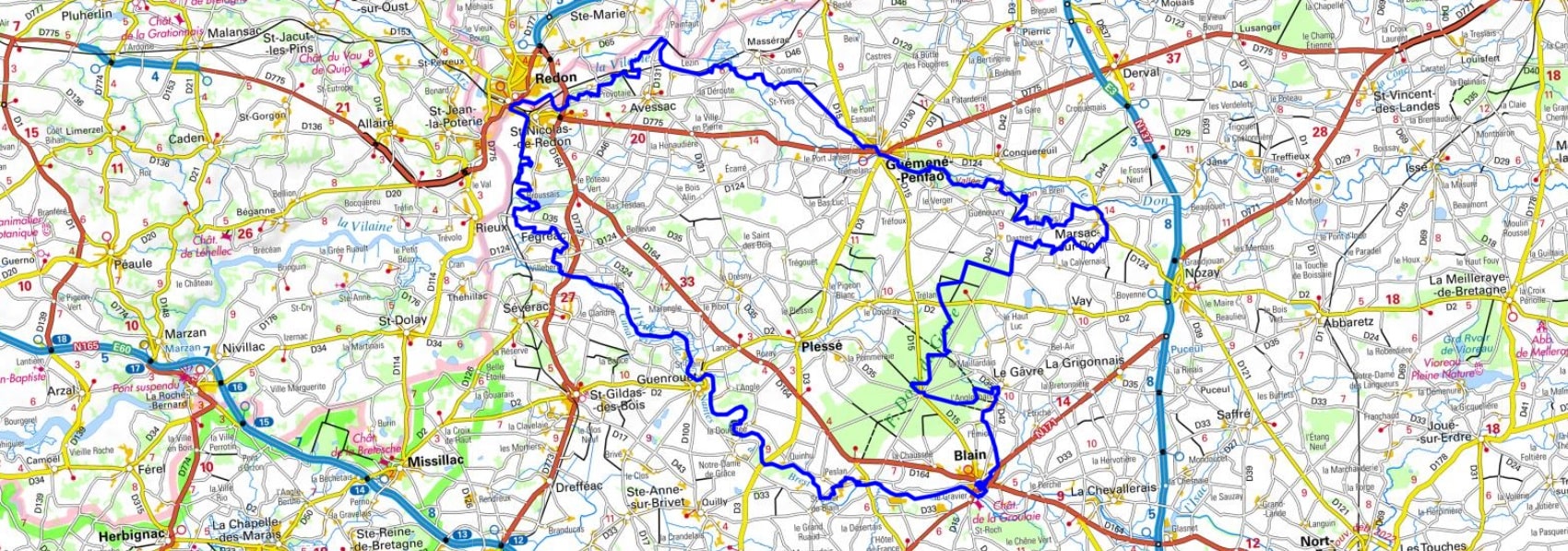
Loop around the three rivers (Ille-et-Vilaine, Loire-Atlantique)
|

|
Hike in Ille-et-Vilaine and Loire-Atlantique department on the three rivers trail (Vilaine, Don and Isac) from Redon via Avessac, Guemene-Penfao, Marsac-sur-Don, Le Gavre, Blain, Guenrouet, Fegreac and Saint-Nicolas-de-Redon. Guest House, Bed and Breakfast, Hotel, Camping, Shelter, Inn, Shops.
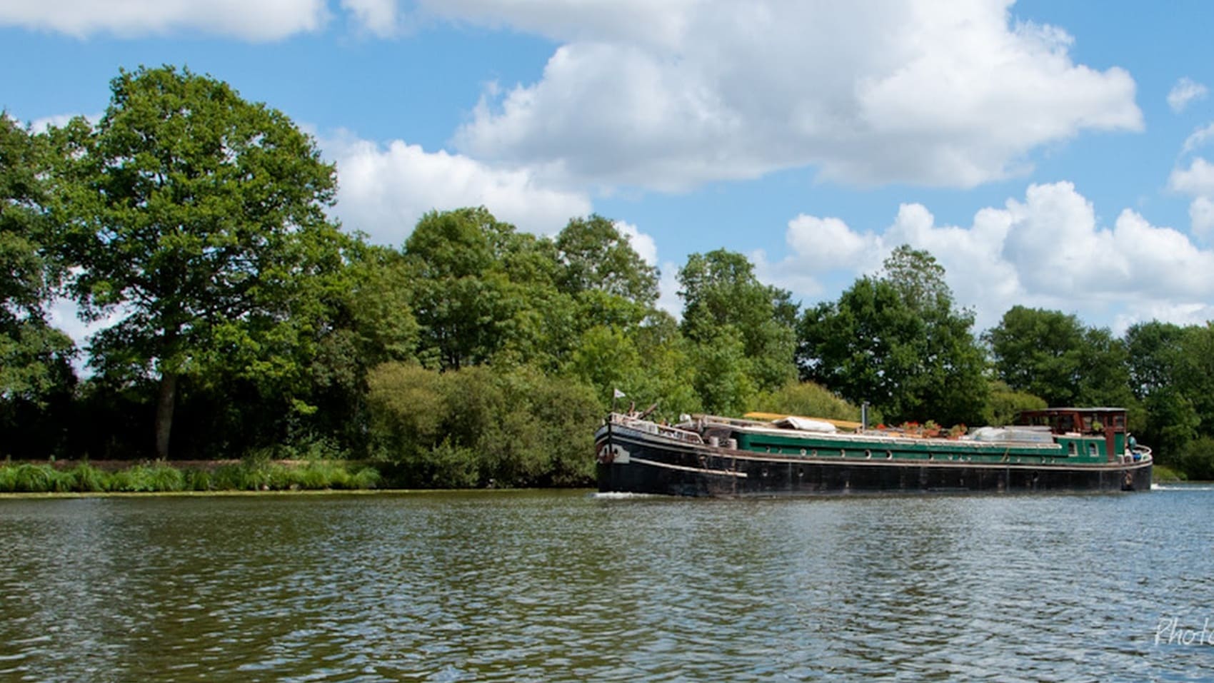
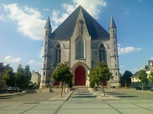
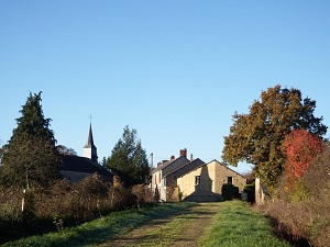
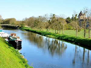
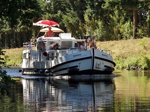
The loop of the three rivers is a 137 kilometer hiking trail located in the departments of Ille-et-Vilaine and Loire-Atlantique, in France. It follows the courses of the Vilaine, Don and Isac rivers, and offers a variety of landscapes, from forests to marshes. The trail begins in Redon, a historic town located on the Vilaine River. It then follows the Vilaine towards the south, crossing forests, fields and villages. At Fégréac, the path leaves the Vilaine to follow the Don towards the north. The Don is a narrower river than the Vilaine, and the path crosses hillier landscapes. At Nozay, the path leaves the Don to follow the Isaac towards the east. The Isac is a smaller river than the Don, and the trail crosses wilder landscapes.
Google Maps - Google Earth
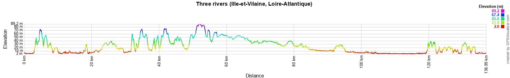
 Distance: 137km, Elevation maximum: 89m, Elevation minimum: 2m, Elevation gain uphill: 913m
IGN Maps: 1121SB - REDON ST-GILDAS-DES-BOIS. 1122SB - SAVENAY. 1221SB - GUEMENE-PENFAO NOZAY. 1222SB - BLAIN NORT-SUR-ERDRE.
 Nearby paths:
Tour of the Nantes Region (Loire-Atlantique)
GR®3 Loire River trail
GR®34 Customs trail
GR®37 Heart of Brittany
GR®38 From Douarnenez (Finistere) to Redon (Ille-et-Vilaine)
GR®39 From Mont St Michel (Manche) to Hoscas (Loire-Atlantique)
 It is advisable to follow the beacons all along your hike and to bring you the FFRandonnee topo-guide. You
will also find information on MonGR.fr.
It is advisable to follow the beacons all along your hike and to bring you the FFRandonnee topo-guide. You
will also find information on MonGR.fr.
GR®, PR®, GRP®, and the corresponding signs of markings (white / red, yellow and yellow / red) are trademarks of the French
Federation of Hiking. They may not be reproduced without permission. The French Federation of Hiking, state-approved, includes organizations that create and maintain hiking routes on GR®, PR® and
GRP®. It publishes guides these topo hiking routes. With your donations, support the actions of the thousands of volunteer markers of the FFRandonnee.
GR-Infos.com is an editorial partner of MonGR.fr.


Former holiday hotel with a garden along the Allier, L'Etoile Guest House is located in La Bastide-Puylaurent between Lozere, Ardeche, and the Cevennes in the mountains of Southern France. At the crossroads of GR®7, GR®70 Stevenson Path, GR®72, GR®700 Regordane Way, GR®470 Allier River springs and gorges, GRP® Cevenol, Ardechoise Mountains, Margeride. Numerous loop trails for hiking and one-day biking excursions. Ideal for a relaxing and hiking getaway.
Copyright©gr-infos.com (Authorization for private use only)