
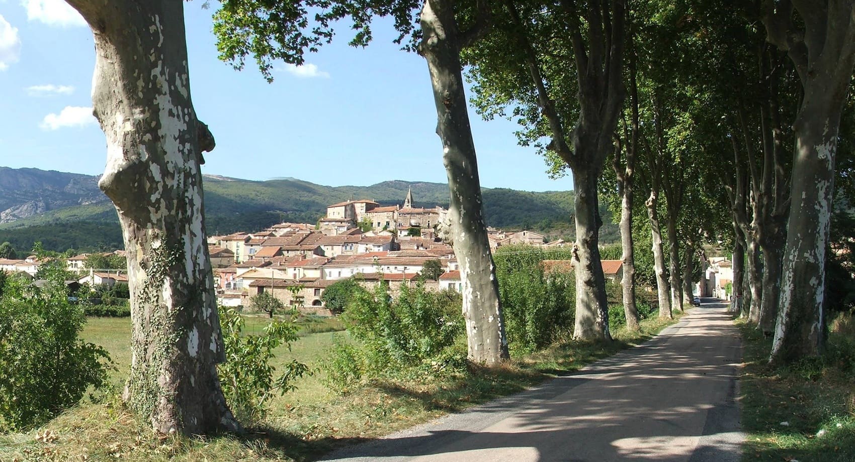
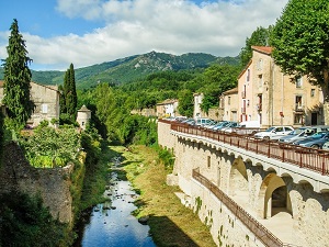
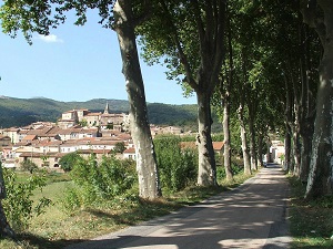
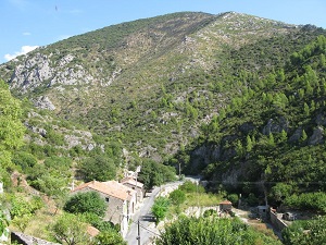
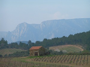
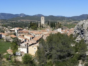
The GR787 long-distance hiking trail winds its way between the foothills of the Cévennes mountains and the vineyards of southern France, from the medieval village of Saint-Gervais-sur-Mare to Le Poujol-sur-Orb at the foot of the Caroux massif. Following the meanders of the Orb River, hikers discover Roquebrun, nicknamed "Little Nice" for its microclimate and exotic garden. The trail then passes through Cessenon-sur-Orb, proud of its keep and its past as a stronghold, illustrating the strategic importance of the valley throughout the centuries. Leaving the riverbanks, the route opens onto the garrigue and vineyard-covered hills leading to Puisserguier, where the medieval castle bears witness to the tumultuous history of the Cathars. Nature becomes more horizontal, bathed in golden light, until the final apotheosis in Capestang with its majestic Saint-Étienne collegiate church, its Archbishops' castle and the famous Canal du Midi.
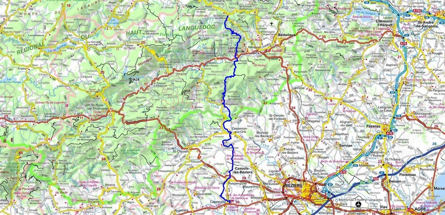
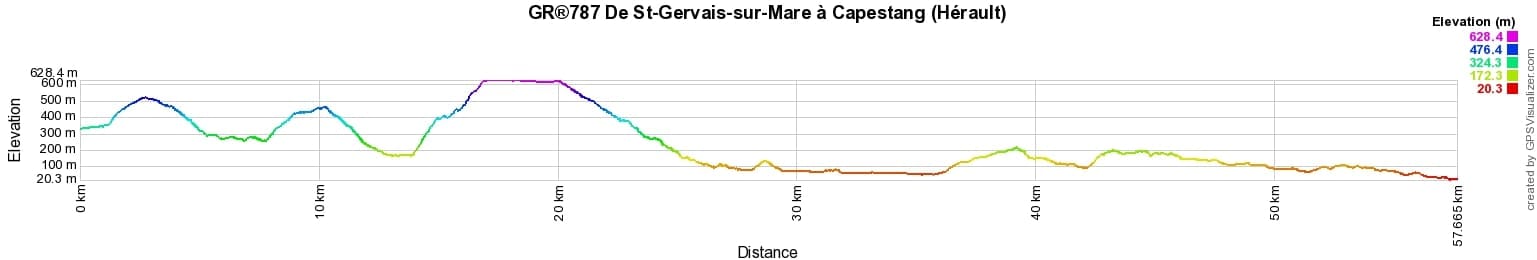
 Distance: 57km, Maximum elevation: 639m, Minimum elevation: 20m, Total ascent: 1385m
IGN Maps: 2543OT - LAMALOU-LES-BAINS / L'ESPINOUSE / LE CAROUX / PNR DU HAUT LANGUEDOC. 2545ET - BEZIERS. 2545OT - SAINT-CHINIAN / L'ETANG DE MONTADY.
Nearby paths:
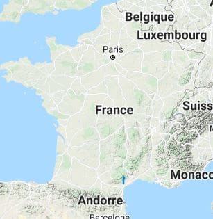
![]() It is advisable to follow the beacons all along your hike and to bring the FFRandonnee topo-guide with you. You will also find information on MonGR.fr.
It is advisable to follow the beacons all along your hike and to bring the FFRandonnee topo-guide with you. You will also find information on MonGR.fr.
GR®, PR®, GRP®, and the corresponding signs of markings (white / red, yellow and yellow / red) are trademarks of the French Federation of Hiking. They may not be reproduced without permission. The French Federation of Hiking, state-approved, includes organizations that create and maintain hiking routes on GR®, PR® and GRP®. It publishes guides for these topo hiking routes. With your donations, you support the actions of the thousands of volunteer markers of the FFRandonnee.
GR-Infos.com is an editorial partner of MonGR.fr.
| Return |

Former holiday hotel with a garden along the Allier, L'Etoile Guest House is located in La Bastide-Puylaurent between Lozere, Ardeche, and the Cevennes in the mountains of Southern France. At the crossroads of GR®7, GR®70 Stevenson Path, GR®72, GR®700 Regordane Way, GR®470 Allier River springs and gorges, GRP® Cevenol, Ardechoise Mountains, Margeride. Numerous loop trails for hiking and one-day biking excursions. Ideal for a relaxing and hiking getaway.
Copyright©gr-infos.com (Authorization for private use only)
To help us maintain and improve GR-Infos.com, a contribution of 2€ is desired via Wero or bank transfer. Thank you!