
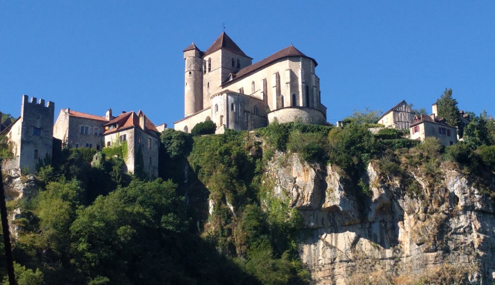
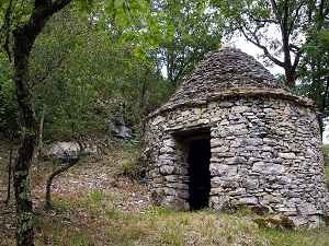
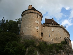
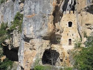
The GR651 is a variant of the Way of St. James, following the meanders of the Célé River through a steep-sided canyon where golden limestone cliffs shelter spectacular troglodyte dwellings, such as those at Sauliac-sur-Célé. History is ever-present, with the remains of the Benedictine abbey of Marcilhac-sur-Célé, a masterpiece of Romanesque art, partly built outdoors. Nature is preserved and bountiful, blending the coolness of the river with the aridity of the surrounding limestone plateaus. Hikers cross forests of downy oak and encounter a rich vernacular heritage of cazelles (small stone huts) and dry-stone walls. The highlight of the route is at the confluence with the Lot River, where the trail reaches Saint-Cirq-Lapopie, a medieval village perched on a cliff with its 13th- and 15th-century half-timbered houses.
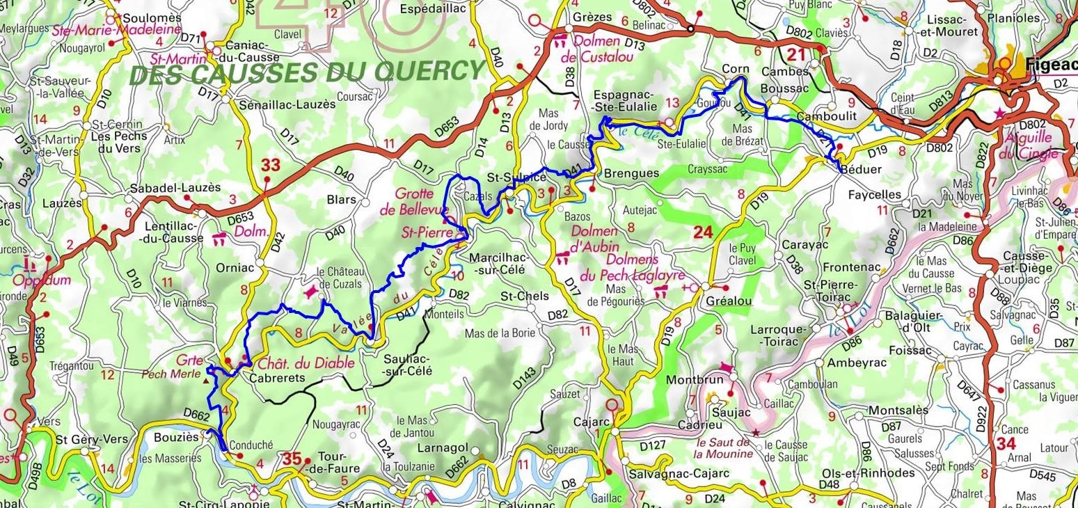
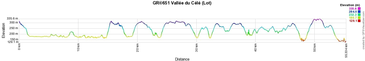

 Distance: 54.32km, Elevation maximum: 338m, Elevation minimum: 139m, Elevation gain uphill: 1568m
IGN Maps: Cahors St-Cirq-Lapopie Vallees du Lot and du Cele (2138OT). Cajarc (2238O).
Nearby paths:
![]() It is advisable to follow the beacons throughout your itinerary and to take the Fédération Française de la Randonnée Pédestre topo-guide with you. You will also find information on MonGR.fr.
It is advisable to follow the beacons throughout your itinerary and to take the Fédération Française de la Randonnée Pédestre topo-guide with you. You will also find information on MonGR.fr.
GR®, PR®, GRP®, and the corresponding signs of markings (white / red, yellow and yellow / red) are trademarks of the French Federation of Hiking. They may not be reproduced without permission. The French Federation of Hiking, state-approved, includes organizations that create and maintain hiking routes on GR®, PR®, and GRP®. It publishes guides for these topo hiking routes. With your donations, you support the actions of the thousands of FFRandonnée volunteer markers.
GR-Infos.com is an editorial partner of MonGR.fr.
| Return |

Former holiday hotel with a garden along the Allier, L'Etoile Guest House is located in La Bastide-Puylaurent between Lozere, Ardeche, and the Cevennes in the mountains of Southern France. At the crossroads of GR®7, GR®70 Stevenson Path, GR®72, GR®700 Regordane Way, GR®470 Allier River springs and gorges, GRP® Cevenol, Ardechoise Mountains, Margeride. Numerous loop trails for hiking and one-day biking excursions. Ideal for a relaxing and hiking getaway.
Copyright©gr-infos.com (Authorization for private use only)
To help us maintain and improve GR-Infos.com, a contribution of 2€ is desired via Wero or bank transfer. Thank you!