
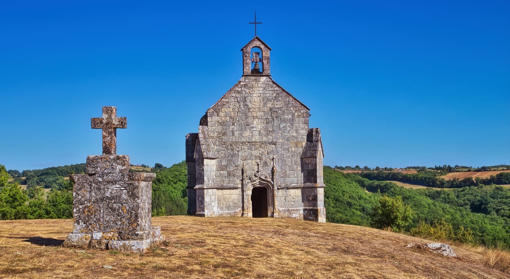
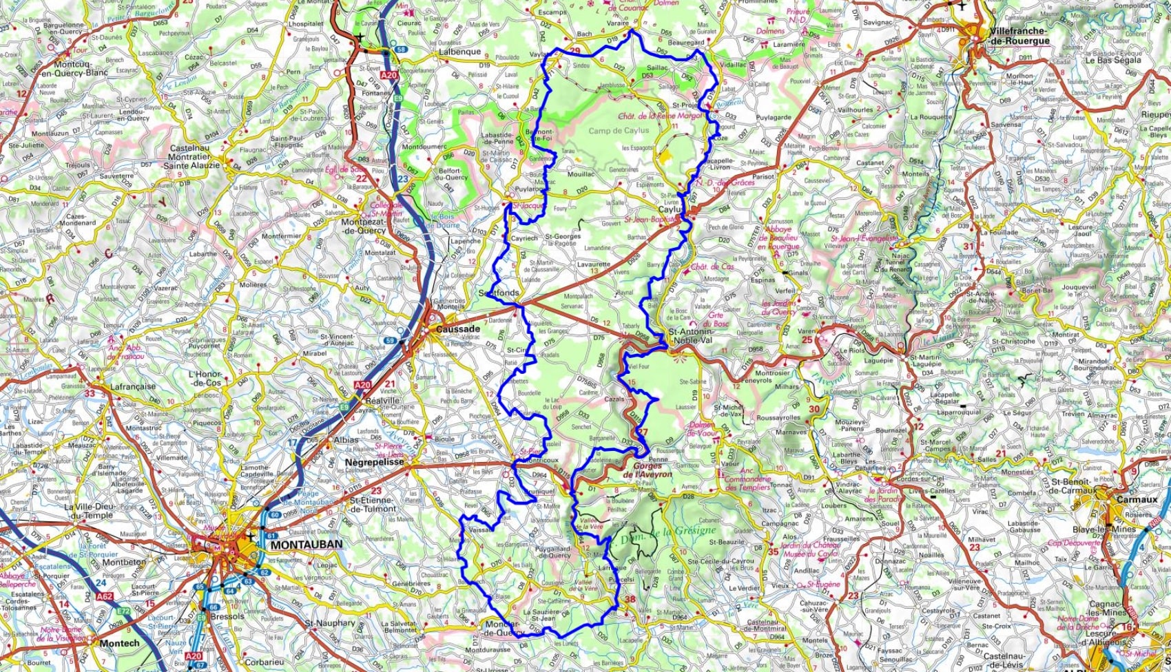
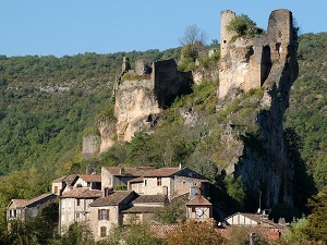
From the town of Caylus, this mineral journey crosses the Quercy Blanc region and the Aveyron Gorges. The route leads to Saint-Antonin-Noble-Val at the foot of the cliffs, then on to the villages of Penne and Bruniquel. Between the Grésigne forest and fortified towns like Puycelsi, the limestone sculpts wild landscapes. Heritage sites dot the route, from the dolmens of Septfonds to the panoramic views of Puylaroque. The hiker then traverses the Lot plateaus, between phosphate mines and dry stone walls. In Varaire and Beauregard, the path bears witness to an ancestral pastoral tradition that still thrives. The tranquility of the wide-open spaces reigns between Saint-Projet and Loze, accompanied by the song of the cicadas. The loop ends in Lacapelle-Livron, marked by the legacy of its Templar commandery.
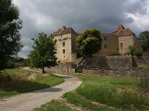
The region is rich in history. It has been inhabited by humans since prehistoric times, as evidenced by the many archaeological sites that have been discovered in the region. In the Middle Ages, Midi Quercy was an important center of power. Many bastides, fortified villages, were built in the region at this time. Midi Quercy is also a region rich in nature. The limestone hills, verdant valleys, and oak forests offer stunning scenery. The region is also an important habitat for wildlife. Many species of birds, mammals, and reptiles can be found here. Finally, Midi Quercy is a region rich in culture. There are many medieval villages, castles, churches, and bastides to be found.
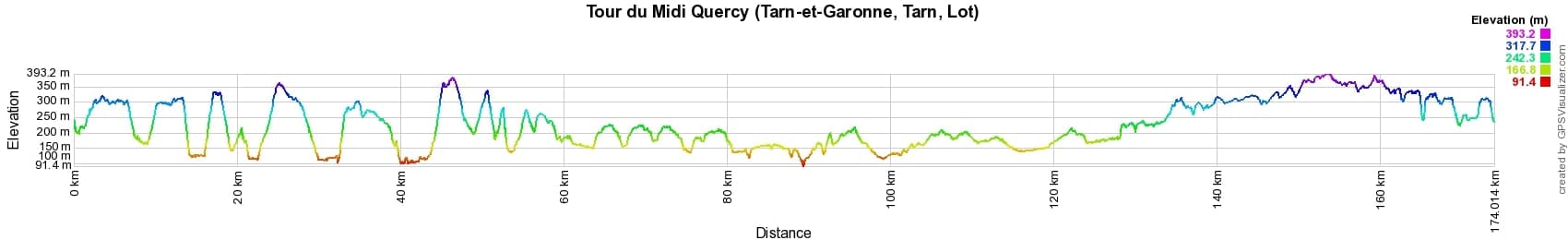


 Distance: 174km, Elevation maximum: 393m, Elevation minimum: 91m, Elevation gain uphill: 3227m
IGN Maps: 2139SB - CAHORS / LIMOGNE-EN-QUERCY. 2140SB - CAUSSADE / SAINT-ANTONIN-NOBLE-VAL. 2141SB - NEGREPELISSE / MONCLAR-DE-QUERCY. 2239SB - VILLEFRANCHE-DE-ROUERGUE / MARTIEL. 2240SB - NAJAC / VAREN / LAGUPIE.

Nearby paths:
![]() It is advisable to follow the beacons all along your hike and to bring the FFRandonnée topo-guide. You will also find information on MonGR.fr.
It is advisable to follow the beacons all along your hike and to bring the FFRandonnée topo-guide. You will also find information on MonGR.fr.
GR®, PR®, GRP® and the corresponding markings are trademarks of the French Federation of Hiking. They may not be reproduced without permission. The French Federation of Hiking, state-approved, includes organizations that maintain hiking routes. It publishes guides for these routes. With your donations, support the actions of the thousands of volunteer markers of the FFRandonnée.
GR-Infos.com is an editorial partner of MonGR.fr.
| Return |

Former holiday hotel with a garden along the Allier, L'Etoile Guest House is located in La Bastide-Puylaurent between Lozere, Ardeche, and the Cevennes in the mountains of Southern France. At the crossroads of GR®7, GR®70 Stevenson Path, GR®72, GR®700 Regordane Way, GR®470 Allier River springs and gorges, GRP® Cevenol, Ardechoise Mountains, Margeride. Numerous loop trails for hiking and one-day biking excursions. Ideal for a relaxing and hiking getaway.
Copyright©gr-infos.com (Authorization for private use only)
To help us maintain and improve GR-Infos.com, a contribution of 2€ is desired via Wero or bank transfer. Thank you!