
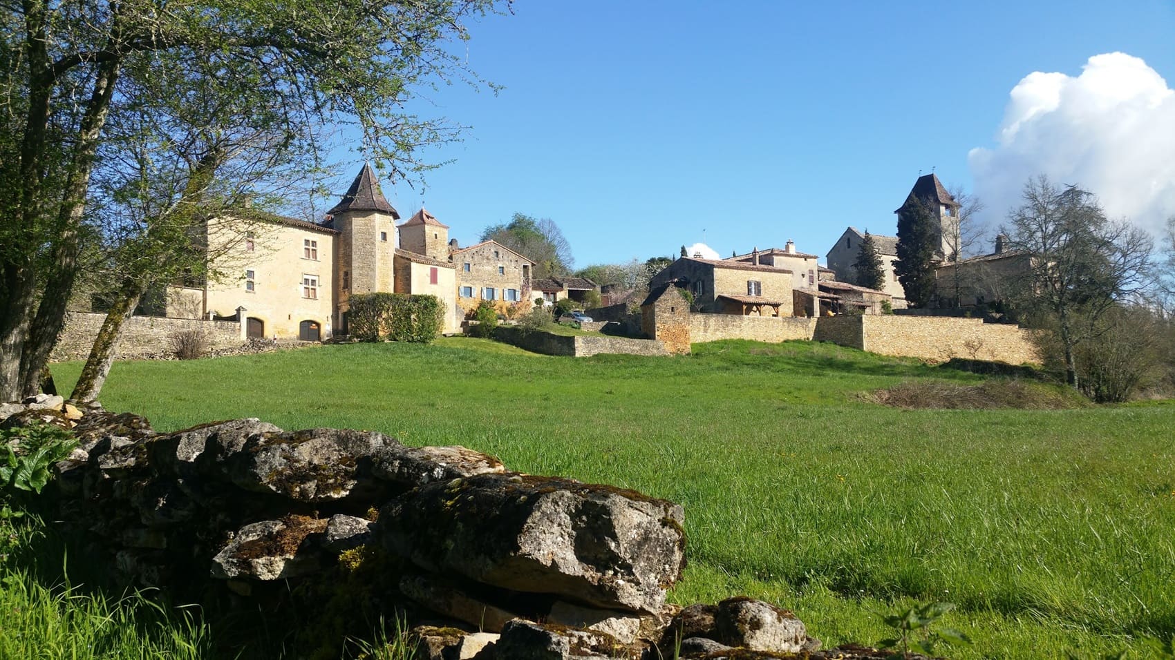
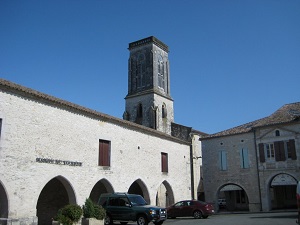
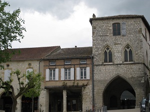
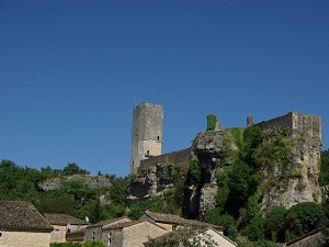
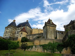
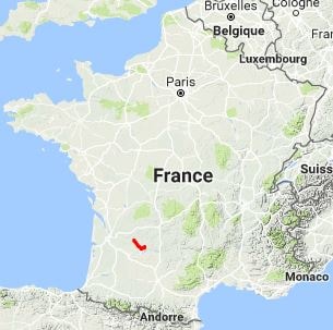
The GR636 is a true immersion into the Upper Agenais Périgord region, an area where the landscape undulates between verdant valleys and limestone plateaus, traversing lands that were the scene of Franco-English rivalry during the Hundred Years' War. The architectural heritage is the highlight of the hike, with the route passing through emblematic fortified towns (bastides). Castillonnès, a 13th-century new town, and especially Monflanquin, listed among the "Most Beautiful Villages of France," bear witness to rigorous urban planning and a rich medieval history. In terms of nature, hikers will find themselves in a mosaic of landscapes: orchards of Ente plum trees, fields of sunflowers, and groves of oak trees. As you approach Lacapelle-Biron, the environment becomes more forested and wild, marking the transition to the Périgord Noir massif.
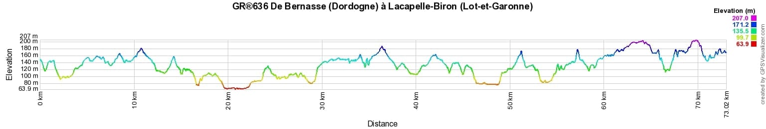
 Distance: 73km, Elevation maximum: 211m, Elevation minimum: 65m, Elevation gain uphill: 1054m
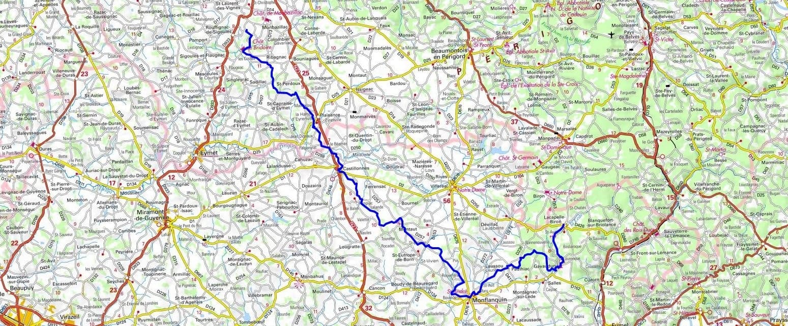
IGN Maps: Castillonnes (1837E). Eymet (1837O). Cancon (1838E). Monflanquin (1938O).
Nearby paths:
![]() It is advisable to follow the beacons throughout your itinerary and to take the Fédération Française de la Randonnée Pédestre topo-guide with you. You will also find information on MonGR.fr.
It is advisable to follow the beacons throughout your itinerary and to take the Fédération Française de la Randonnée Pédestre topo-guide with you. You will also find information on MonGR.fr.
GR®, PR®, GRP®, and the corresponding signs of markings (white / red, yellow and yellow / red) are trademarks of the French Federation of Hiking. They may not be reproduced without permission. The French Federation of Hiking, state-approved, includes organizations that create and maintain hiking routes on GR®, PR®, and GRP®. It publishes guides for these topo hiking routes. With your donations, you support the actions of the thousands of FFRandonnée volunteer markers.
GR-Infos.com is an editorial partner of MonGR.fr.
| Return |

Former holiday hotel with a garden along the Allier, L'Etoile Guest House is located in La Bastide-Puylaurent between Lozere, Ardeche, and the Cevennes in the mountains of Southern France. At the crossroads of GR®7, GR®70 Stevenson Path, GR®72, GR®700 Regordane Way, GR®470 Allier River springs and gorges, GRP® Cevenol, Ardechoise Mountains, Margeride. Numerous loop trails for hiking and one-day biking excursions. Ideal for a relaxing and hiking getaway.
Copyright©gr-infos.com (Authorization for private use only)
To help us maintain and improve GR-Infos.com, a contribution of 2€ is desired via Wero or bank transfer. Thank you!