
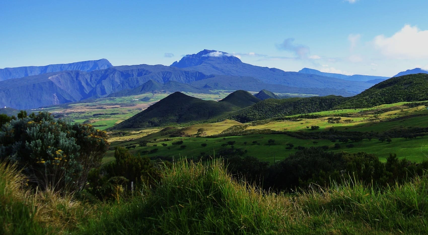
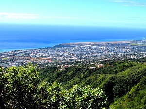
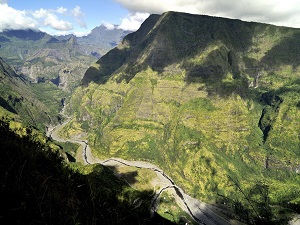
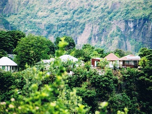
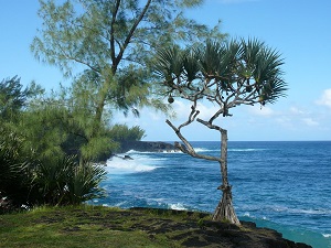
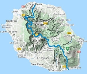
Starting from Saint-Denis, the GR®R2 trail climbs rapidly towards Roche Écrite, offering a first panoramic view of the cirques, natural refuges once prized by runaway slaves (maroonage). Upon entering the Cirque de Cilaos, hikers discover a unique heritage, marked by the cultivation of vines and lentils, at the foot of the majestic Piton des Neiges, which rises to over 3,000 meters. Nature reigns supreme here: the trail passes from the tamarind forests of the highlands to the lunar landscapes of the Plaine des Sables, a veritable gateway to the Piton de la Fournaise volcano. The route then becomes an immersion in the mineral world, where successive lava flows bear witness to the ceaseless activity of one of the world's most active volcanoes. The final descent towards Le Baril (Saint-Philippe) offers a striking contrast, plunging the vertical, mineral face of the volcano into the deep blue of the Indian Ocean.
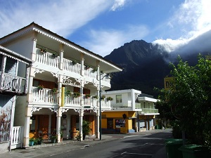
Rising from the depths of the Indian Ocean, Reunion Island is a volcanic land of impetuous character, shaped by the majestic Piton des Neiges. Its history is a crossroads of civilizations, marked by maroon communities and the abolition of slavery, leaving behind a vibrant Creole culture and a unique architectural heritage of colorful houses. The island's rugged terrain is revealed through the three natural cirques of Cilaos, Salazie, and Mafate, the latter accessible only on foot. Volcanic activity remains alive thanks to Piton de la Fournaise, one of the world's most active volcanoes, whose lava flows regularly reshape the landscape of the Grand Brûlé. Between the turquoise lagoons of L'Ermitage and the high-altitude savannas, the ecological diversity is exceptional, offering varied microclimates within just a few kilometers.
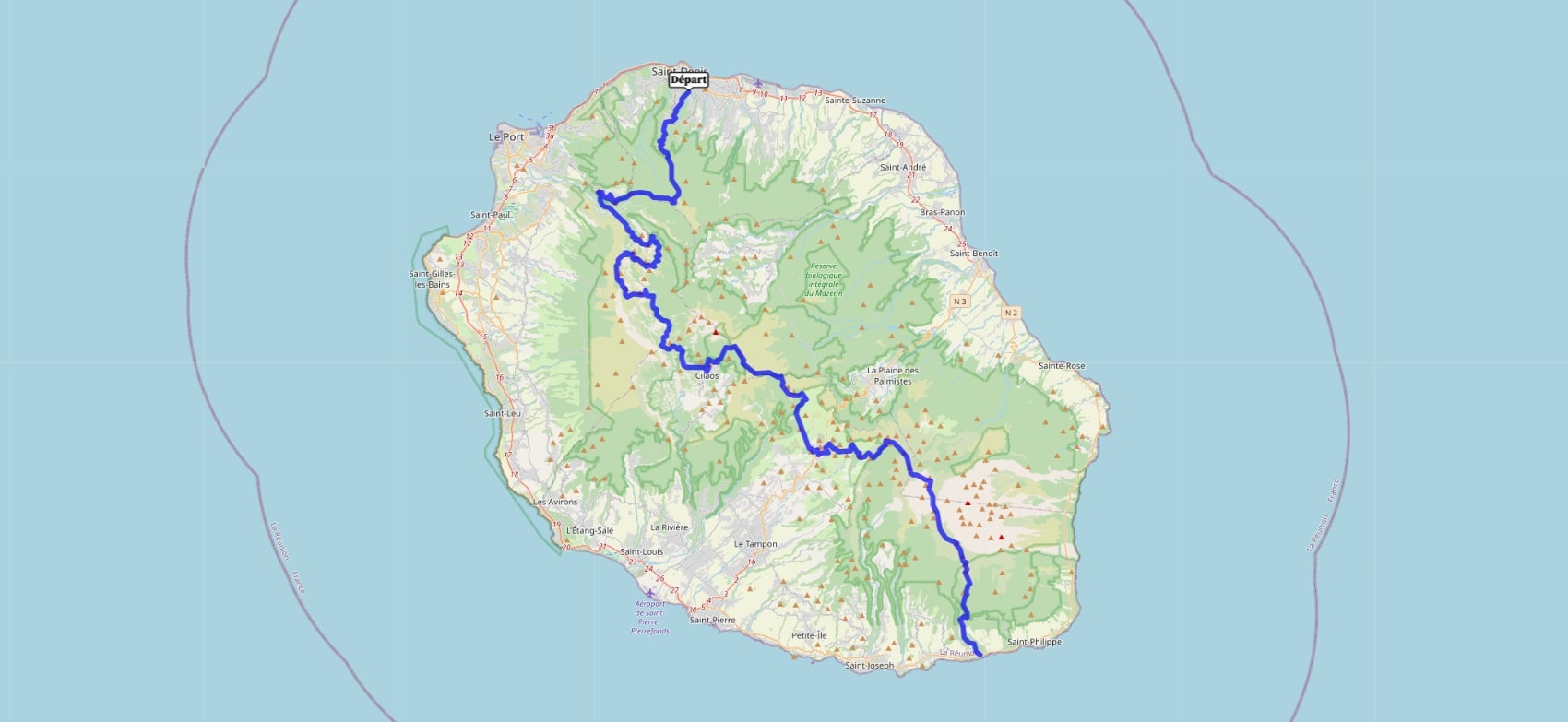
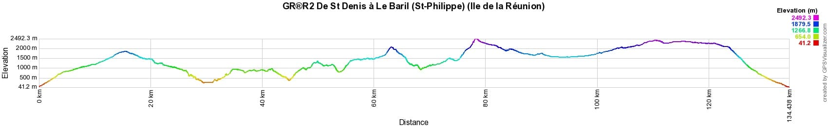
 Distance: 134km, Maximum elevation: 2496m, Minimum elevation: 41m, Total ascent: 10122m
IGN Maps: St-Denis Cirques de Mafate et de Salazie (4402RT). Saint-Pierre (4405RT).
Nearby paths:
![]() It is advisable to follow the beacons all along your hike and to bring the FFRandonnee topo-guide with you. You will also find information on MonGR.fr.
It is advisable to follow the beacons all along your hike and to bring the FFRandonnee topo-guide with you. You will also find information on MonGR.fr.
GR®, PR®, GRP®, and the corresponding signs of markings (white / red, yellow and yellow / red) are trademarks of the French Federation of Hiking. They may not be reproduced without permission. The French Federation of Hiking, state-approved, includes organizations that create and maintain hiking routes on GR®, PR® and GRP®. It publishes guides for these topo hiking routes. With your donations, you support the actions of the thousands of volunteer markers of the FFRandonnee.
GR-Infos.com is an editorial partner of MonGR.fr.
| Return |

Former holiday hotel with a garden along the Allier, L'Etoile Guest House is located in La Bastide-Puylaurent between Lozere, Ardeche, and the Cevennes in the mountains of Southern France. At the crossroads of GR®7, GR®70 Stevenson Path, GR®72, GR®700 Regordane Way, GR®470 Allier River springs and gorges, GRP® Cevenol, Ardechoise Mountains, Margeride. Numerous loop trails for hiking and one-day biking excursions. Ideal for a relaxing and hiking getaway.
Copyright©gr-infos.com (Authorization for private use only)
To help us maintain and improve GR-Infos.com, a contribution of 2€ is desired via Wero or bank transfer. Thank you!