
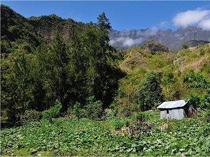
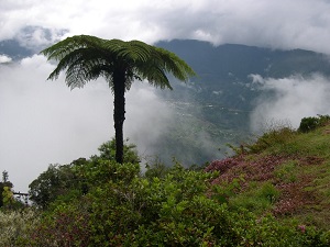
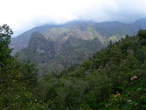
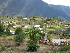
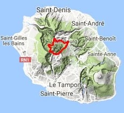
The GR®R1, a jewel of hiking on Reunion Island, lies at the heart of Piton des Neiges, the oldest volcano in the Indian Ocean. This loop trail winds through the island's three majestic cirques: Salazie, Cilaos, and Mafate. The history of this route is deeply linked to "marronage," serving as a reminder of the refuge sought by runaway slaves within these inaccessible natural ramparts. The landscapes are breathtakingly vertical, alternating between forests of native trees, crystalline waterfalls, and lunar volcanic plateaus, featuring unique endemic flora such as tree ferns and tamarind trees. The trail traverses the small hamlets of Mafate, accessible only on foot, where time seems to stand still in an atmosphere of mountain solidarity. The final ascent to the summit of the volcano, reaching 3,070 meters, offers a 360° panorama of the ocean at sunrise.
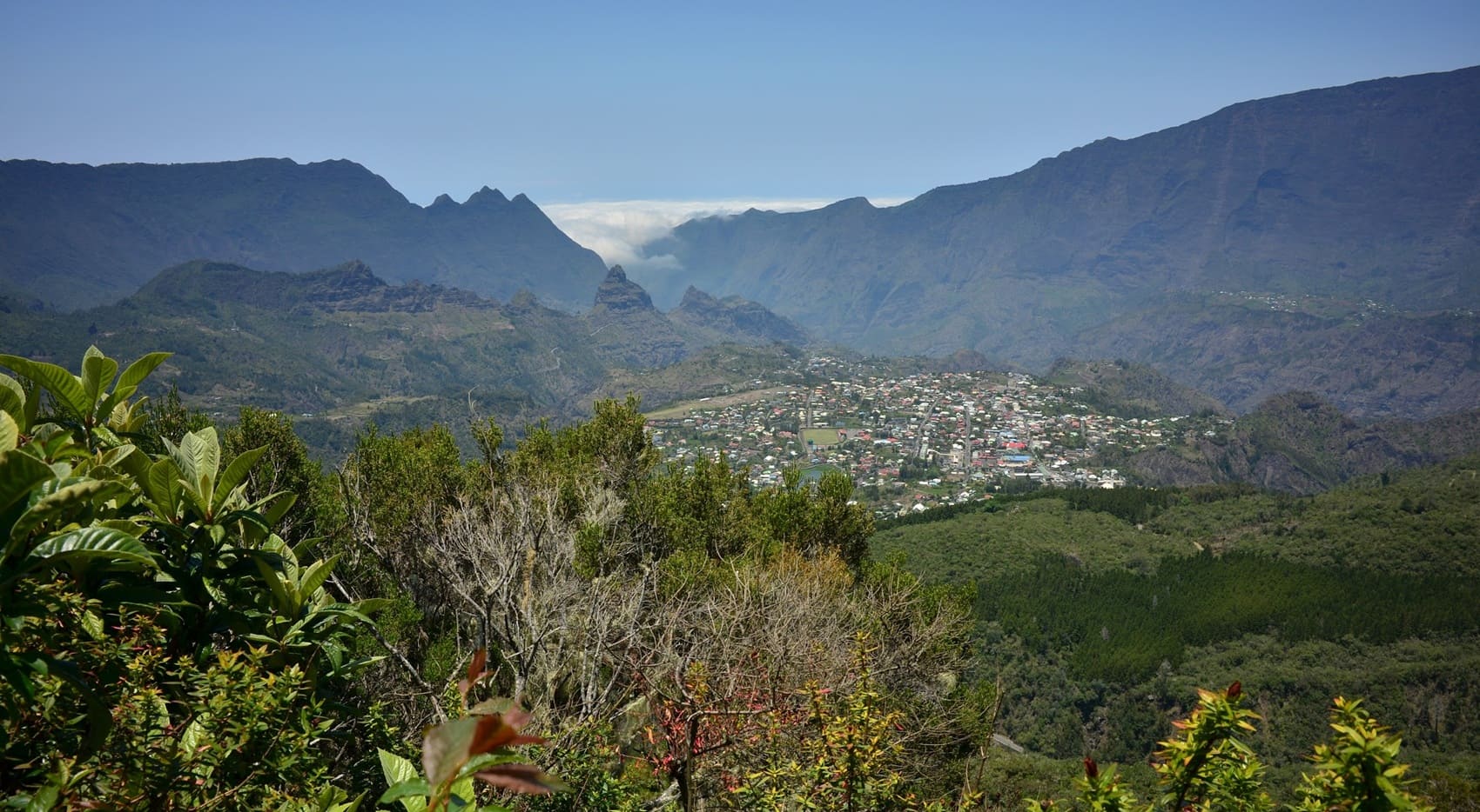
Piton des Neiges is the oldest volcano and the highest peak on Reunion Island. Born over two million years ago, this dormant giant is the very architect of the island, having shaped the three majestic cirques of Mafate, Salazie, and Cilaos through its successive collapses. Its ascent, often begun at night from the Caverne Dufour refuge, is a rite of passage for any hiker seeking the absolute. At the summit, the sunrise reveals a magnificent, mineral panorama encompassing the entirety of the island's rugged landscape. The massif shelters a biodiversity that is unique in the world, where forests of native trees and high-altitude moors protect rare endemic species. Although its name evokes snow, snow remains an exceptional phenomenon on its dark volcanic slopes, serving as a reminder of the harshness of the high-altitude climate in the tropics.
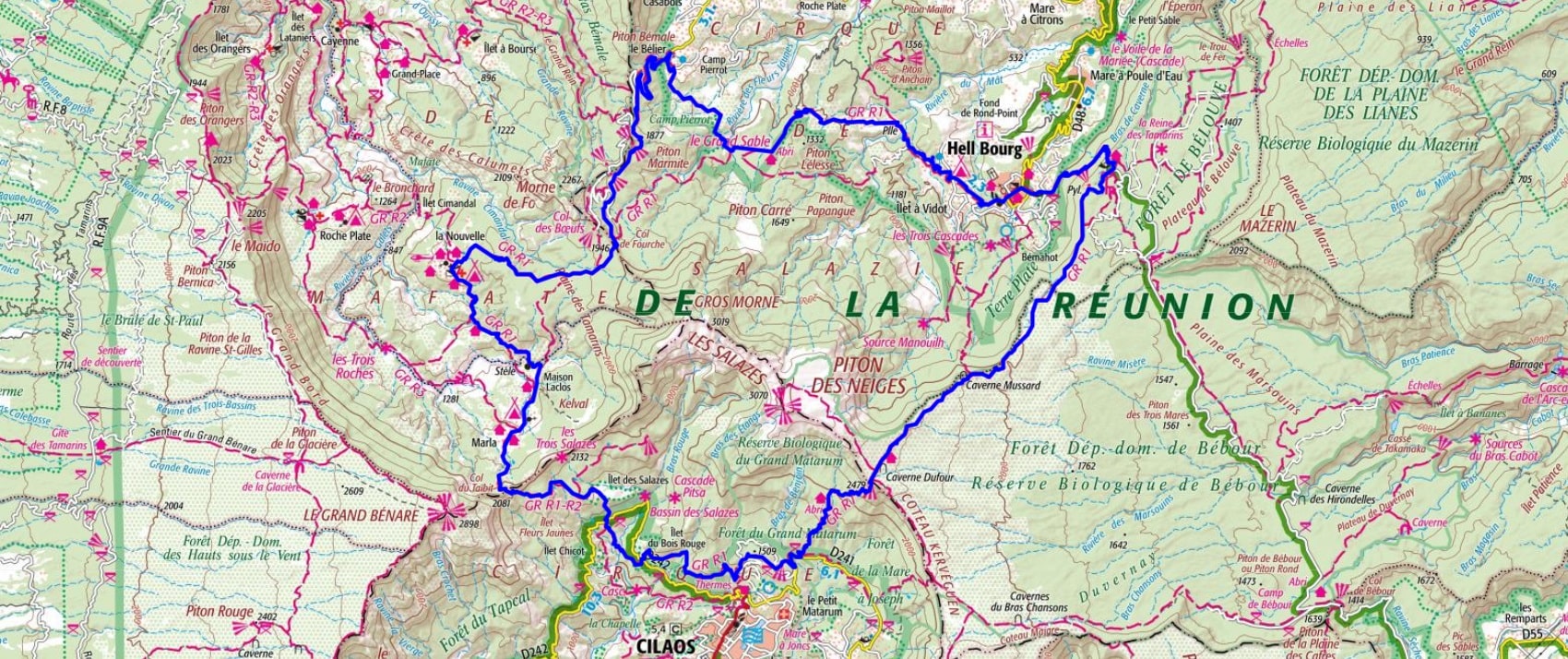
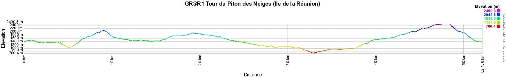
 Distance: 52km, Maximum elevation: 2494m, Minimum elevation: 699m, Total ascent: 4614m
IGN Maps: St-Denis Cirques de Mafate et de Salazie (4402RT). Saint-Pierre (4405RT).
Nearby paths:
![]() It is advisable to follow the beacons all along your hike and to bring the FFRandonnee topo-guide with you. You will also find information on MonGR.fr.
It is advisable to follow the beacons all along your hike and to bring the FFRandonnee topo-guide with you. You will also find information on MonGR.fr.
GR®, PR®, GRP®, and the corresponding signs of markings (white / red, yellow and yellow / red) are trademarks of the French Federation of Hiking. They may not be reproduced without permission. The French Federation of Hiking, state-approved, includes organizations that create and maintain hiking routes on GR®, PR® and GRP®. It publishes guides for these topo hiking routes. With your donations, you support the actions of the thousands of volunteer markers of the FFRandonnee.
GR-Infos.com is an editorial partner of MonGR.fr.
| Return |

Former holiday hotel with a garden along the Allier, L'Etoile Guest House is located in La Bastide-Puylaurent between Lozere, Ardeche, and the Cevennes in the mountains of Southern France. At the crossroads of GR®7, GR®70 Stevenson Path, GR®72, GR®700 Regordane Way, GR®470 Allier River springs and gorges, GRP® Cevenol, Ardechoise Mountains, Margeride. Numerous loop trails for hiking and one-day biking excursions. Ideal for a relaxing and hiking getaway.
Copyright©gr-infos.com (Authorization for private use only)
To help us maintain and improve GR-Infos.com, a contribution of 2€ is desired via Wero or bank transfer. Thank you!