
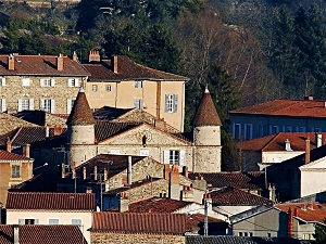
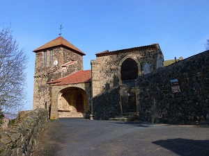
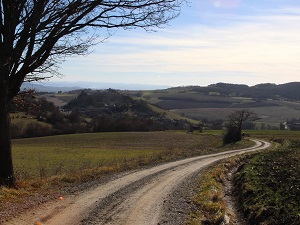
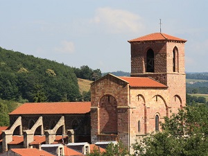
Starting in Sauxillanges, a former Cluniac town, the historical trail follows in the footsteps of Marguerite de Valois, exiled to the Auvergne region, and quickly leads to the perched village of Usson, listed among the most beautiful in France, where the queen resided for twenty years. The route then winds between Orbeil and Saint-Babel, alternating between basalt plateaus and verdant valleys sculpted by volcanic erosion. Nature is bountiful here, offering breathtaking panoramas of the Chaîne des Puys and the Sancy massif in the distance. Passing through authentic hamlets like Manglieu, famous for its royal abbey, one discovers a built heritage of blond arkose stone that contrasts with the deep green of the oak forests. The gentle terrain of the route, passing through Sugères and Mouteix, allows one to appreciate the local biodiversity, from traditional orchards to protected wetlands.

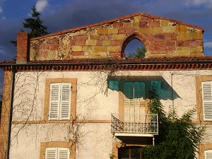
The site known as the Queen Margot site is centered around the Château d'Usson in the Puy-de-Dôme department, famous for having been the place of exile for Marguerite de Valois for nearly twenty years. The landscape is marked by a steep basalt peak upon which the fortress once stood, offering a commanding view over the fertile valleys of the Auvergne region. The history of the site is inextricably linked to the fate of the queen, who held a brilliant court there despite her captivity, making this château an unexpected cultural center at the end of the 16th century. The local flora consists of deciduous forests and meadows, typical of this transitional zone between the mountains and the plains. The fauna is that of the Auvergne bocage and mid-altitude woodlands, including numerous bird species and small mammals, which today benefit from the ruins in an environment that is both wild and steeped in history.
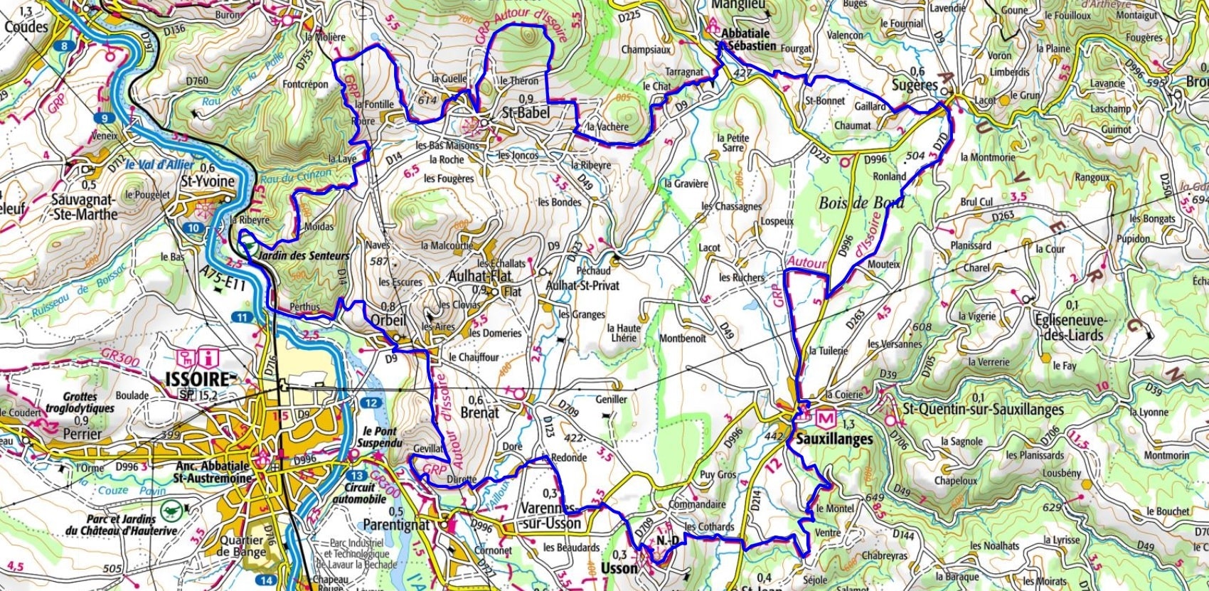
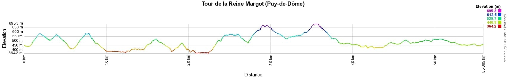
 Distance: 56km, Elevation maximum: 701m, Elevation minimum: 367m, Elevation gain uphill: 1431m
IGN Maps: Issoire (2632O). St-Germain-Lembron (2633O).
Nearby paths:
![]() It is advisable to follow the beacons all along your hike and to bring the FFRandonnée topo-guide. You will also find information on MonGR.fr.
It is advisable to follow the beacons all along your hike and to bring the FFRandonnée topo-guide. You will also find information on MonGR.fr.
GR®, PR®, GRP® and the corresponding markings are trademarks of the French Federation of Hiking. They may not be reproduced without permission. The French Federation of Hiking, state-approved, includes organizations that maintain hiking routes. It publishes guides for these routes. With your donations, support the actions of the thousands of volunteer markers of the FFRandonnée.
GR-Infos.com is an editorial partner of MonGR.fr.
| Return |

Former holiday hotel with a garden along the Allier, L'Etoile Guest House is located in La Bastide-Puylaurent between Lozere, Ardeche, and the Cevennes in the mountains of Southern France. At the crossroads of GR®7, GR®70 Stevenson Path, GR®72, GR®700 Regordane Way, GR®470 Allier River springs and gorges, GRP® Cevenol, Ardechoise Mountains, Margeride. Numerous loop trails for hiking and one-day biking excursions. Ideal for a relaxing and hiking getaway.
Copyright©gr-infos.com (Authorization for private use only)
To help us maintain and improve GR-Infos.com, a contribution of 2€ is desired via Wero or bank transfer. Thank you!