
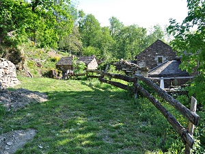
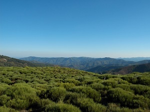
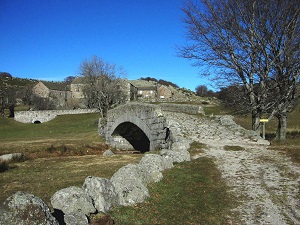
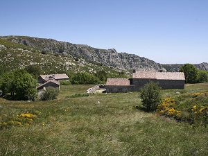
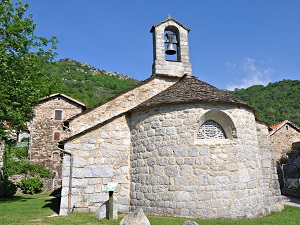
Starting from Chamborigaud, the trail climbs towards the hamlet of Castagnols, a testament to traditional schist architecture, before reaching Saint-Maurice-de-Ventalon in the high granite highlands of Mont Lozère. The landscape becomes spectacular above Gourdouse, where monumental rock formations overlook deep gorges, illustrating the geological power of the Cévennes. Descending towards Vialas, a former silver-lead mining center, the path follows the rushing waters of the Luech River to reach the charming village of Pont-de-Rastel, famous for having inspired the writer Jean-Pierre Chabrol. Between ancient chestnut groves and terraced fields (known locally as "faïsses"), this route tells the story of the Camisard resistance and the agro-pastoral life of the Cévennes. The biodiversity here is remarkable, sheltering golden eagles and beavers in an area protected by the Cévennes National Park.
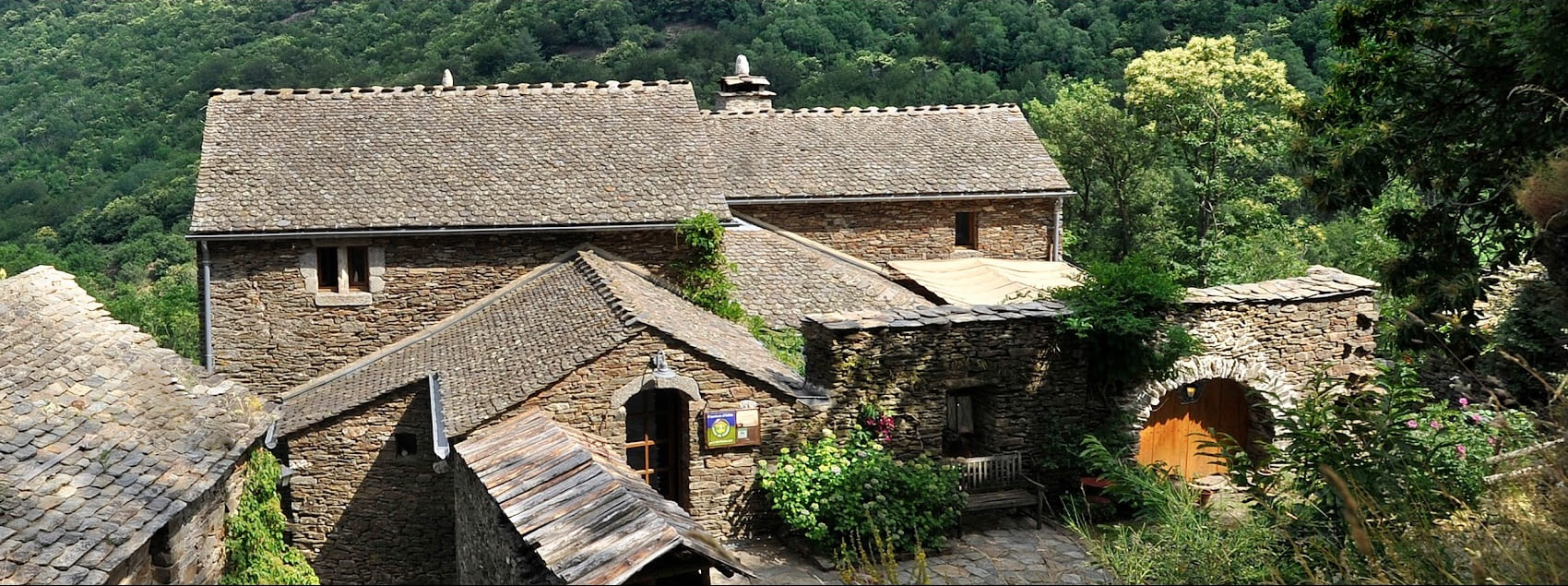
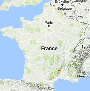
Born on the slopes of Mont Lozère, the Upper Luech Valley stretches across the Gard region like a wild fault line in the heart of the schistous Cévennes mountains. This territory is marked by the history of the Camisards and a culture of resistance, where each hamlet of gray stone seems to cling to the mountainside. The built heritage is remarkable, with its agricultural terraces, called faïsses, which bear witness to centuries of hard work to tame the slope and cultivate the chestnut tree, the local "bread tree." Nature reigns supreme here, offering crystal-clear waters prized for swimming in the deep pools of the Luech and dense forests of holm oaks and pines. Between the Château de Portes, a stone fortress overlooking the pass, and the villages of Chamborigaud and Vialas, the valley alternates between panoramic ridges and secluded valleys. Within the Cévennes National Park, it shelters preserved fauna, from the beaver to the short-toed eagle, in absolute calm.
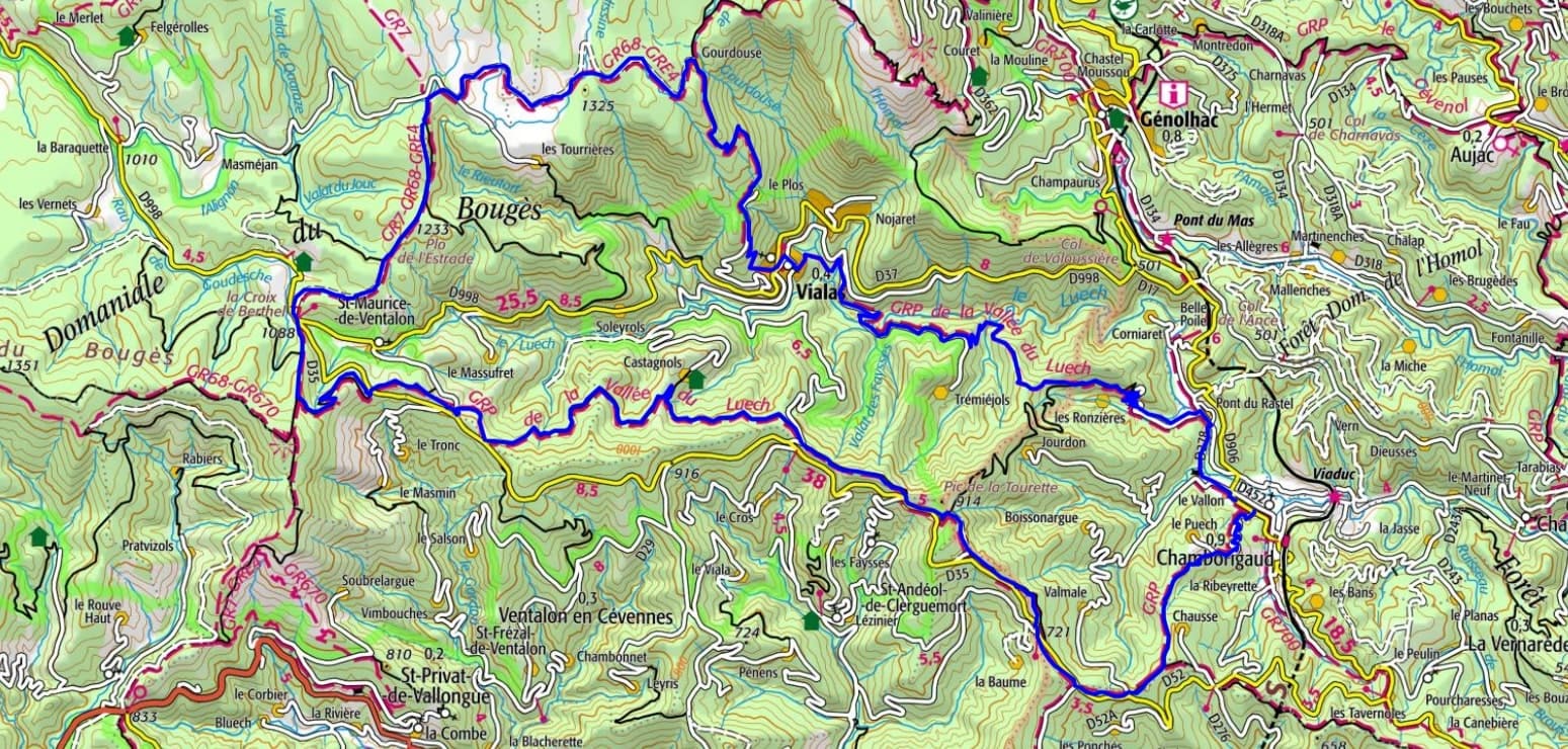
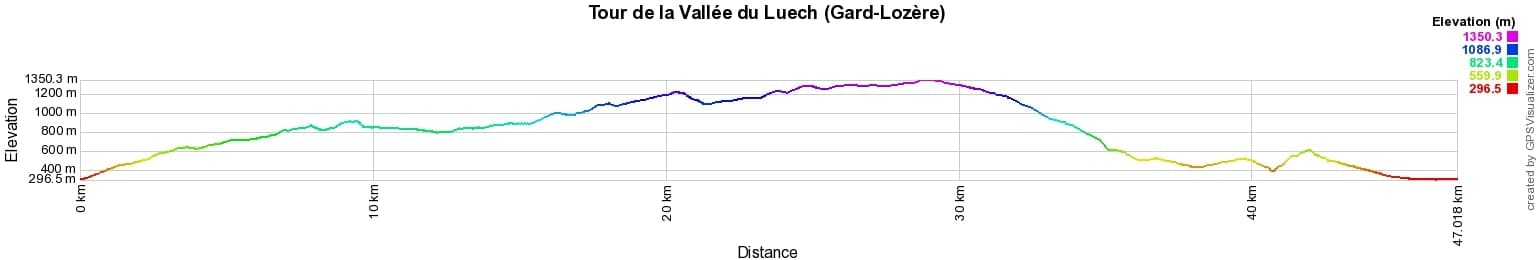
 Distance: 47km, Elevation maximum: 1349m, Elevation minimum: 297m, Elevation gain uphill: 1785m
IGN Maps: Mont Lozère Florac PN des Cévennes (2739OT). Corniche des Cévennes PN des Cévennes (2740ET). Bessèges Les Vans Vallée du Chassezac (2839OT).
Nearby paths:
![]() It is advisable to follow the beacons all along your hike and to bring the FFRandonnée topo-guide. You will also find information on MonGR.fr.
It is advisable to follow the beacons all along your hike and to bring the FFRandonnée topo-guide. You will also find information on MonGR.fr.
GR®, PR®, GRP® and the corresponding markings are trademarks of the French Federation of Hiking. They may not be reproduced without permission. The French Federation of Hiking, state-approved, includes organizations that maintain hiking routes. It publishes guides for these routes. With your donations, support the actions of the thousands of volunteer markers of the FFRandonnée.
GR-Infos.com is an editorial partner of MonGR.fr.
| Return |

Former holiday hotel with a garden along the Allier, L'Etoile Guest House is located in La Bastide-Puylaurent between Lozere, Ardeche, and the Cevennes in the mountains of Southern France. At the crossroads of GR®7, GR®70 Stevenson Path, GR®72, GR®700 Regordane Way, GR®470 Allier River springs and gorges, GRP® Cevenol, Ardechoise Mountains, Margeride. Numerous loop trails for hiking and one-day biking excursions. Ideal for a relaxing and hiking getaway.
Copyright©gr-infos.com (Authorization for private use only)
To help us maintain and improve GR-Infos.com, a contribution of 2€ is desired via Wero or bank transfer. Thank you!