
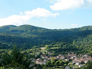
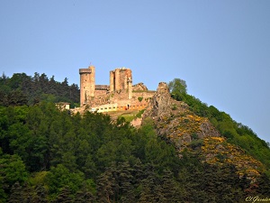
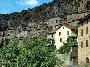
Starting in Retournac, the trail climbs towards Saint-Ignac and Bas-en-Basset, revealing the majestic ruins of Rochebaron Castle, which have watched over the valley since the 12th century. Passing through Aurec-sur-Loire and its medieval heart, hikers discover a rich heritage, from fortified houses to dark stone churches. The route alternates between pine forests, volcanic plateaus, and steep paths overlooking the shimmering waters of the river. The passage through Monistrol-sur-Loire and the isolated hamlets of Cublaise and Peyre reveals a preserved rural life, its rhythm dictated by the volcanic peaks typical of the Velay region. Biodiversity flourishes in these protected areas, where birds of prey soar above a diverse range of wild flora, from broom heaths to damp undergrowth.
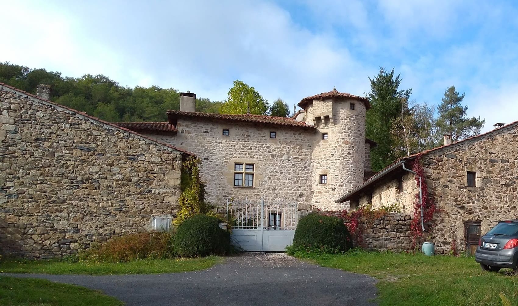
The Loire Gorges, between the Haute-Loire and Loire departments, have shaped a thousand-year history marked by the defense of the Velay region's borders. In Retournac, the past is etched in the stone of fortified houses and the art of lacemaking, while Beauzac preserves the traces of a fortified medieval town overlooking the river. Further downstream, Bas-en-Basset displays the imposing silhouette of the ruins of Rochebaron Castle, a 12th-century feudal sentinel offering a strategic panorama of the valley. In Monistrol-sur-Loire, the Château des Évêques du Puy testifies to the ecclesiastical power that once governed these rugged lands. Finally, Aurec-sur-Loire retains its character as a medieval town, protected by its castle and ramparts that guarded the passage of the wild river. This castle heritage, nestled in unspoiled nature, tells the story of a time when the Loire Gorges were a vital and contested communication route. Between Cluniac sites and granite fortresses, the history of this territory can be read along the water, where man has had to deal with an untamable landscape.
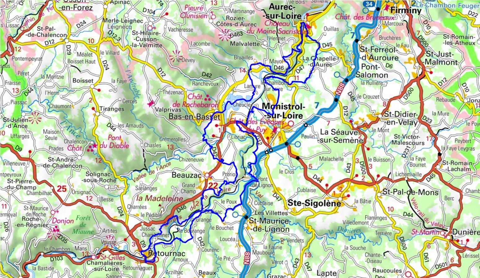
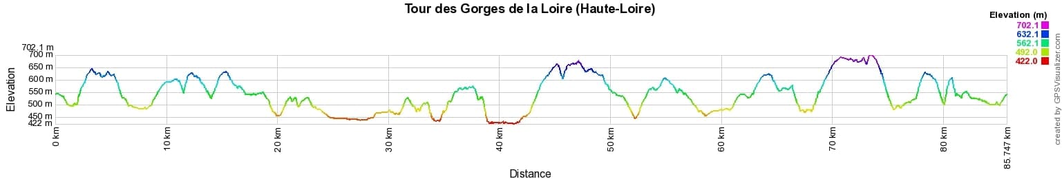

 Distance: 85km, Elevation maximum: 702m, Elevation minimum: 423m, Elevation gain uphill: 2141m
IGN Maps: 2833SB - FIRMINY / SAINT-BONNET-LE-CHÂTEAU. 2834SB - MONISTROL-SUR-LOIRE / RETOURNAC. 2835OT - LE PUY-EN-VELAY / YSSINGEAUX.

Nearby paths:
![]() It is advisable to follow the trail markers all along your hike and to bring the FFRandonnée topo-guide. You will also find information on MonGR.fr.
It is advisable to follow the trail markers all along your hike and to bring the FFRandonnée topo-guide. You will also find information on MonGR.fr.
GR®, PR®, GRP® and the corresponding markings are trademarks of the French Federation of Hiking. They may not be reproduced without permission. The French Federation of Hiking, state-approved, includes organizations that maintain hiking routes. It publishes guides for these routes. With your donations, support the actions of the thousands of volunteer markers of the FFRandonnée.
GR-Infos.com is an editorial partner of MonGR.fr.
| Return |

Former holiday hotel with a garden along the Allier, L'Etoile Guest House is located in La Bastide-Puylaurent between Lozere, Ardeche, and the Cevennes in the mountains of Southern France. At the crossroads of GR®7, GR®70 Stevenson Path, GR®72, GR®700 Regordane Way, GR®470 Allier River springs and gorges, GRP® Cevenol, Ardechoise Mountains, Margeride. Numerous loop trails for hiking and one-day biking excursions. Ideal for a relaxing and hiking getaway.
Copyright©gr-infos.com (Authorization for private use only)
To help us maintain and improve GR-Infos.com, a contribution of 2€ is desired via Wero or bank transfer. Thank you!