
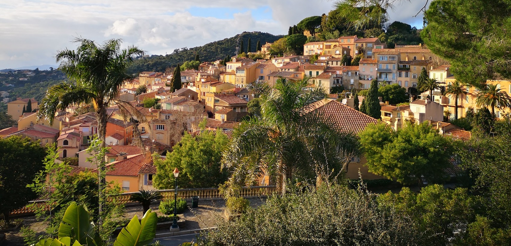
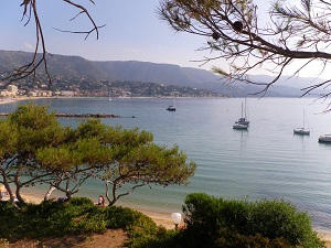
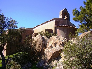
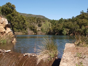
The Massif des Maures is one of the oldest geological formations in Provence. Its name, derived from the Provençal word "maouro" (“dark wood”), evokes the density of its forest cover. The GR®90 long-distance hiking trail traverses landscapes of rare diversity: cork oak forests harvested for centuries, ancient chestnut groves around Collobrières, and fragrant scrublands filled with heather and strawberry trees. The ascent culminates at the sanctuary of Notre-Dame des Anges (768 m), founded, according to legend, by the son of Clovis in 517. From this spiritual vantage point, hikers can enjoy a 360° panorama stretching from the Îles d'Hyères to the snow-capped peaks of the Alps, overlooking a sea of green that has remained fiercely preserved.
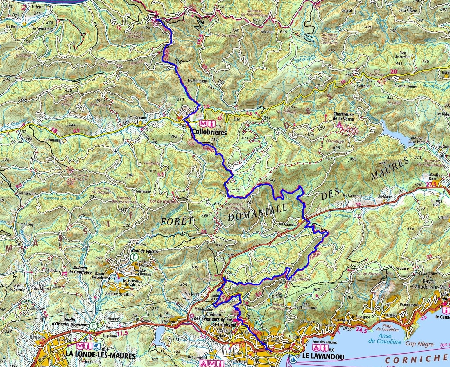
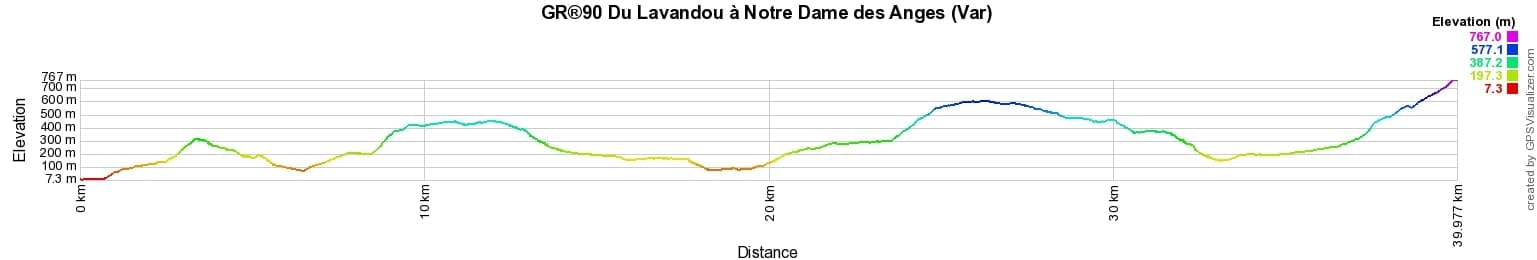
 Distance: 40km, Elevation maximum: 760m, Elevation minimum: 9m, Elevation gain uphill: 1942m
IGN Maps: Cuers Pierrefeu-du-Var Collobrieres massif des Maures (3445OT). Le Lavandou PN de Port Cros Corniche des Maures (3446ET). St-Tropez Ste-Maxime massif des Maures (3545OT).
Nearby paths:
![]() It is advisable to follow the beacons all along your hike and to bring the FFRandonnee topo-guide. You will also find information on MonGR.fr.
It is advisable to follow the beacons all along your hike and to bring the FFRandonnee topo-guide. You will also find information on MonGR.fr.
GR®, PR®, GRP®, and the corresponding signs of markings (white/red, yellow and yellow/red) are trademarks of the French Federation of Hiking. They may not be reproduced without permission. The French Federation of Hiking, state-approved, includes organizations that create and maintain hiking routes on GR®, PR® and GRP®. It publishes guides for these topo hiking routes. With your donations, support the actions of the thousands of volunteer markers of the FFRandonnee.
GR-Infos.com is an editorial partner of MonGR.fr.
| Return |

Former holiday hotel with a garden along the Allier, L'Etoile Guest House is located in La Bastide-Puylaurent between Lozere, Ardeche, and the Cevennes in the mountains of Southern France. At the crossroads of GR®7, GR®70 Stevenson Path, GR®72, GR®700 Regordane Way, GR®470 Allier River springs and gorges, GRP® Cevenol, Ardechoise Mountains, Margeride. Numerous loop trails for hiking and one-day biking excursions. Ideal for a relaxing and hiking getaway.
Copyright©gr-infos.com (Authorization for private use only)
To help us maintain and improve GR-Infos.com, a contribution of 2€ is desired via Wero or bank transfer. Thank you!