
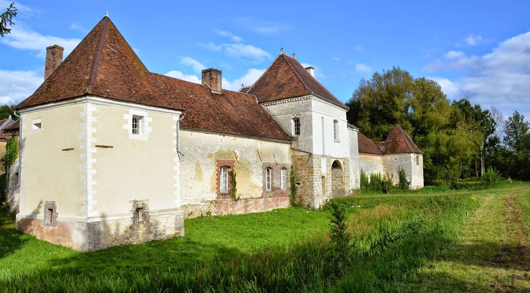
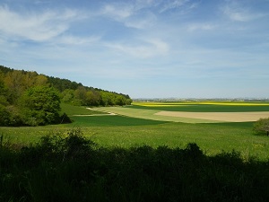
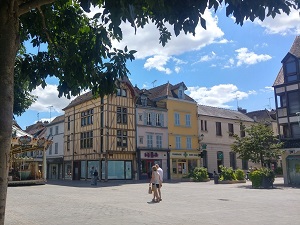
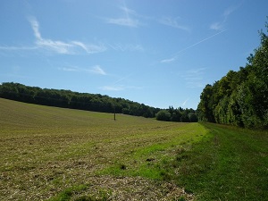
Starting from Vauchassis, the trail winds its way into a wooded massif, alternating between chalky valleys and dense oak groves. The route leads to Sommeval, a picturesque village nestled in a hollow, where the rugged terrain surprises with its almost mountainous character in the heart of Champagne. Heading towards Eaux-Puiseaux, nature blends with cider-making tradition, the flint soil providing the apple orchards with a unique terroir that has made the Pays d'Othe region famous. The heritage is revealed in Maraye-en-Othe, with its ancient churches and half-timbered houses typical of Aube architecture. At Chennegy, the woodland edges offer unobstructed views of the cultivated fields before plunging back under the protective canopy of the vast forests.
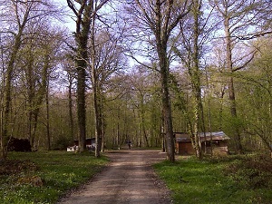
The Othe Forest is a rolling, verdant forest, composed mainly of hardwoods, at an average altitude of 236 meters. It is primarily composed of oaks, beech trees, birches, hornbeams, and ash trees. Rarer species can also be found, such as the spruce, the Scots pine, and the European larch. The Othe Forest is a place of exceptional biodiversity. It is home to a wide variety of animals, including deer, wild boars, roe deer, foxes, badgers, hares, rabbits, raptors, and songbirds. In the Middle Ages, the Othe Forest was an important source of firewood and construction timber. It was also a favored hunting ground for local lords. In the 18th century, the Othe Forest was subjected to intensive exploitation. The wood was used for the construction of ships, bridges, and houses.
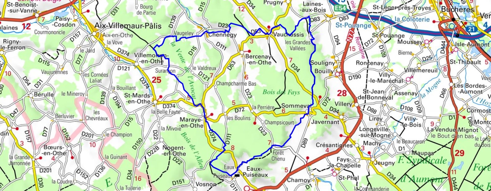
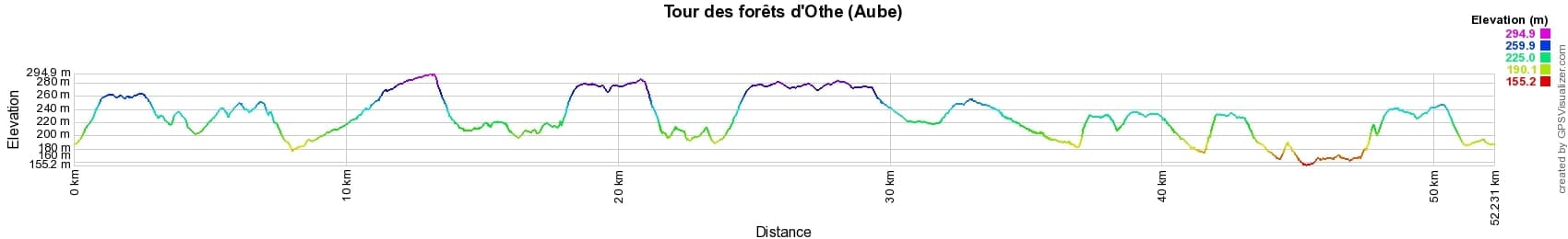
 Distance: 52km, Elevation maximum: 295m, Elevation minimum: 155m, Elevation gain uphill: 828m
IGN Maps: 2717SB - ESTISSAC MARIGNY-LE-CHÂTEL. 2718SB - AUXON RIGNY-LE-FERRON. 2817SB - TROYES LUSIGNY-SUR-BARSE. 2818SB - BOUILLY CLEREY.

Nearby paths:
![]() It is advisable to follow the beacons all along your hike and to bring the FFRandonnée topo-guide. You will also find information on MonGR.fr.
It is advisable to follow the beacons all along your hike and to bring the FFRandonnée topo-guide. You will also find information on MonGR.fr.
GR®, PR®, GRP® and the corresponding markings are trademarks of the French Federation of Hiking. They may not be reproduced without permission. The French Federation of Hiking, state-approved, includes organizations that maintain hiking routes. It publishes guides for these routes. With your donations, support the actions of the thousands of volunteer markers of the FFRandonnée.
GR-Infos.com is an editorial partner of MonGR.fr.
| Return |

Former holiday hotel with a garden along the Allier, L'Etoile Guest House is located in La Bastide-Puylaurent between Lozere, Ardeche, and the Cevennes in the mountains of Southern France. At the crossroads of GR®7, GR®70 Stevenson Path, GR®72, GR®700 Regordane Way, GR®470 Allier River springs and gorges, GRP® Cevenol, Ardechoise Mountains, Margeride. Numerous loop trails for hiking and one-day biking excursions. Ideal for a relaxing and hiking getaway.
Copyright©gr-infos.com (Authorization for private use only)
To help us maintain and improve GR-Infos.com, a contribution of 2€ is desired via Wero or bank transfer. Thank you!