
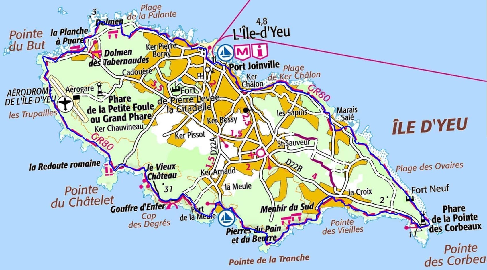
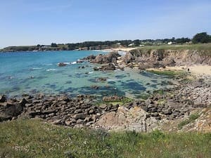
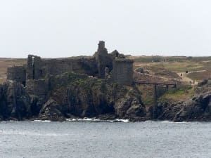
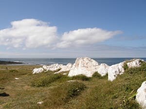
Starting from Port-Joinville, the coastal path around Île d’Yeu offers an immersion into the island's remarkably diverse natural environment. Following the eastern coast towards Marais Salé beach, hikers discover a gentle stretch of fine sand before reaching the Pointe des Corbeaux lighthouse, a sentinel marking the entrance to a wilder area. The landscape then transforms into a rugged "iron coast" with steep cliffs, where Anse des Fontaines offers secluded coves. The highlight of the island's historical heritage is undoubtedly the Vieux Château, a 14th-century medieval fortress built on a rocky spur. Continuing towards Pointe du But, at the westernmost point, the horizon opens onto the open sea, an area once feared by sailors for its reefs. The path then descends towards Gournaise beach, between low-lying heathland and dry-stone walls typical of local architecture.
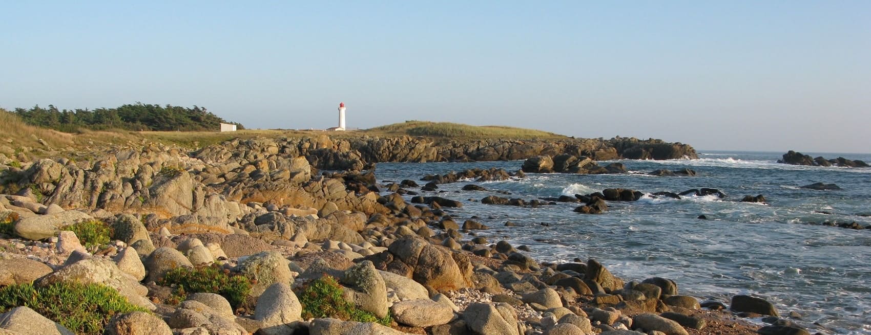
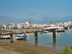
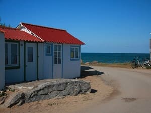
The Île d'Yeu, a jewel of the Vendée region located off the mainland, offers a striking contrast between its two maritime facades. Its eastern coast is lined with fine sandy beaches and maritime pine forests, while its wild southern coast, with its jagged granite cliffs, is reminiscent of Brittany. The island boasts a rich historical heritage, marked by the imposing 14th-century Old Castle, which seems to rise from the rocks above the surf. Exploring the trails reveals a preserved natural landscape of flowering heathland, gorse, and dry-stone walls. The port of La Meule, nestled in a deep cove, bears witness to the tuna and lobster fishing tradition that shaped the island's identity. Villages with white houses and colorful shutters, like Port-Joinville, tell a thousand-year-old story of sailors and famous exiles. Between prehistoric menhirs and monumental lighthouses, the island is ideally explored by bike or on foot to fully appreciate its poetry.
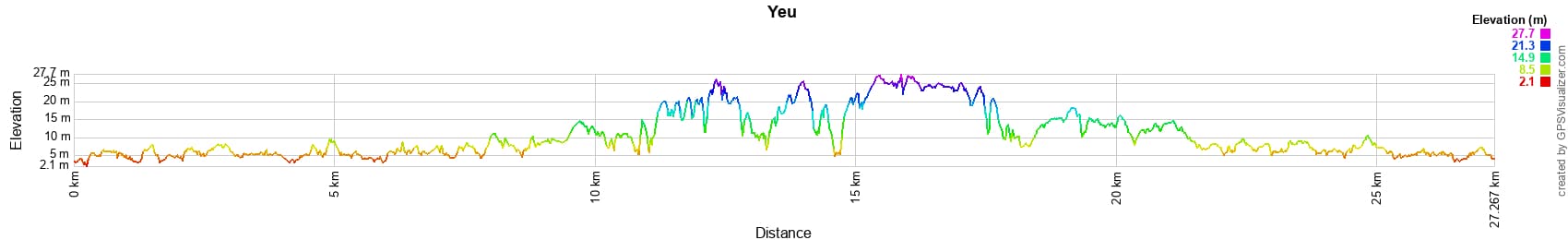
 Distance: 27km, Elevation maximum: 27m, Elevation minimum: 0m, Elevation gain uphill: 86m
IGN Maps: 1126OT - ILE D'YEU / SAINT-GILLES-CROIX-DE-VIE / SAINT-JEAN-DE-MONTS / MARAIS BRETON.
Nearby paths:
![]() It is advisable to follow the trail markers all along your hike and to bring the FFRandonnée topo-guide. You will also find information on MonGR.fr.
It is advisable to follow the trail markers all along your hike and to bring the FFRandonnée topo-guide. You will also find information on MonGR.fr.
GR®, PR®, GRP® and the corresponding markings are trademarks of the French Federation of Hiking. They may not be reproduced without permission. The French Federation of Hiking, state-approved, includes organizations that maintain hiking routes. It publishes guides for these routes. With your donations, support the actions of the thousands of volunteer markers of the FFRandonnée.
GR-Infos.com is an editorial partner of MonGR.fr.
| Return |

Former holiday hotel with a garden along the Allier, L'Etoile Guest House is located in La Bastide-Puylaurent between Lozere, Ardeche, and the Cevennes in the mountains of Southern France. At the crossroads of GR®7, GR®70 Stevenson Path, GR®72, GR®700 Regordane Way, GR®470 Allier River springs and gorges, GRP® Cevenol, Ardechoise Mountains, Margeride. Numerous loop trails for hiking and one-day biking excursions. Ideal for a relaxing and hiking getaway.
Copyright©gr-infos.com (Authorization for private use only)
To help us maintain and improve GR-Infos.com, a contribution of 2€ is desired via Wero or bank transfer. Thank you!