
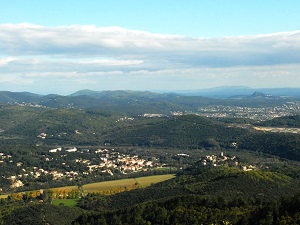
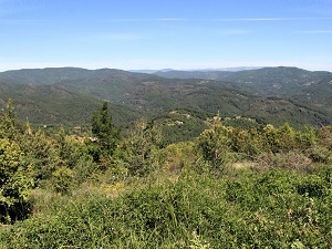
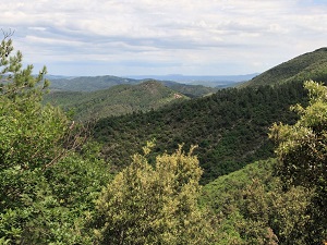
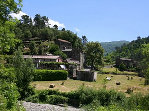
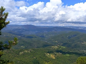
Starting from Cendras, the gateway to the Gard Cévennes, this hike around the Galeizon Valley immerses walkers in a wild landscape. The trail climbs towards La Blaquière and Les Conques, crossing dense chestnut forests, the dominant tree that has shaped the local economy and heritage for centuries. Crossing the border into Lozère near Espinassous and Le Pendédis, one discovers robust schist architecture, a testament to the resistance of the Camisards and the agropastoral life of yesteryear. The landscape opens magnificently at La Croix-des-Vents, offering a panorama of the Cévennes peaks where the silence is broken only by the passage of birds of prey. This unspoiled valley, where exceptionally pure water flows, is a sanctuary of biodiversity, sheltering beavers and otters within its meanders.
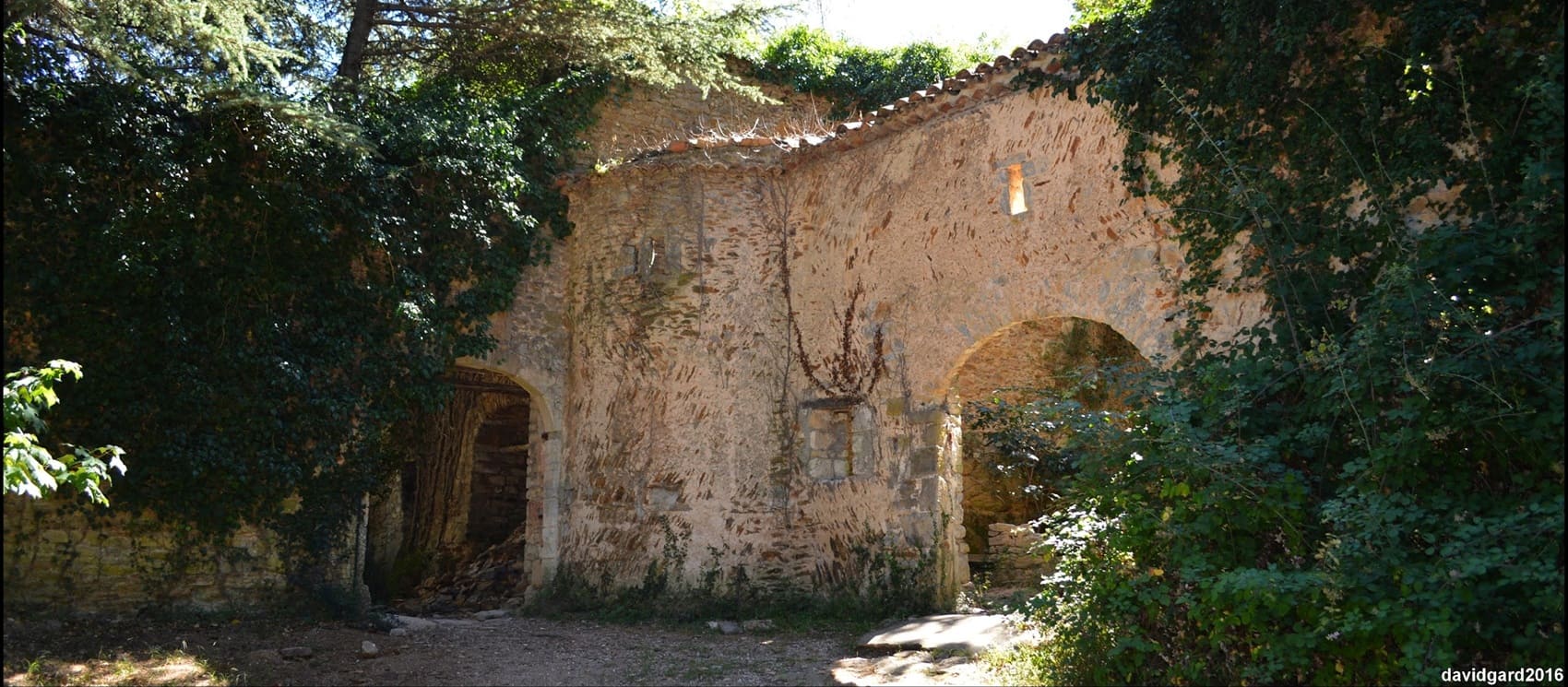
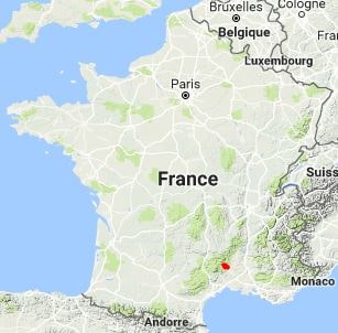
The Galeizon Valley is a geographical and ecological area located at the junction of the Gard and Lozère departments, in the heart of the Cévennes National Park. It is named after the Galeizon, a tributary of the Gardon d'Alès. This valley is emblematic of the southern Cévennes, characterized by its steep reliefs, chestnut and oak forests, and tumultuous rivers. It is a preserved, sparsely populated area of mid-mountain landscape. The Pays de la Vallée du Galeizon has long relied on subsistence agriculture and timber exploitation. Today, it is particularly recognized for its biodiversity. The valley is a popular destination for hiking, with the GR® 700 (Voie Régordane) running through it, as well as the Camisards Trail. Its heritage is marked by traditional Cévenol housing, featuring slate stone farms, many of which have been restored.
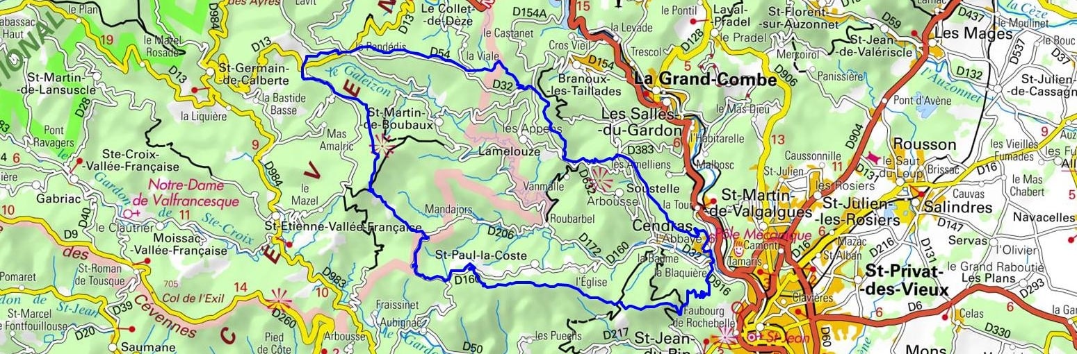
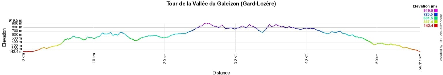
 Distance: 56km, Elevation maximum: 908m, Elevation minimum: 146m, Elevation gain uphill: 2189m
IGN Maps: Corniche des Cévennes PN des Cévennes (2740ET). Alès (2840OT).
Nearby paths:
![]() It is advisable to follow the trail markers all along your hike and to bring the FFRandonnée topo-guide. You will also find information on MonGR.fr.
It is advisable to follow the trail markers all along your hike and to bring the FFRandonnée topo-guide. You will also find information on MonGR.fr.
GR®, PR®, GRP® and the corresponding markings are trademarks of the French Federation of Hiking. They may not be reproduced without permission. The French Federation of Hiking, state-approved, includes organizations that maintain hiking routes. It publishes guides for these routes. With your donations, support the actions of the thousands of volunteer markers of the FFRandonnée.
GR-Infos.com is an editorial partner of MonGR.fr.
| Return |

Former holiday hotel with a garden along the Allier, L'Etoile Guest House is located in La Bastide-Puylaurent between Lozere, Ardeche, and the Cevennes in the mountains of Southern France. At the crossroads of GR®7, GR®70 Stevenson Path, GR®72, GR®700 Regordane Way, GR®470 Allier River springs and gorges, GRP® Cevenol, Ardechoise Mountains, Margeride. Numerous loop trails for hiking and one-day biking excursions. Ideal for a relaxing and hiking getaway.
Copyright©gr-infos.com (Authorization for private use only)
To help us maintain and improve GR-Infos.com, a contribution of 2€ is desired via Wero or bank transfer. Thank you!