
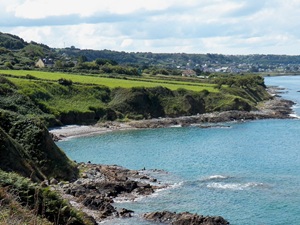
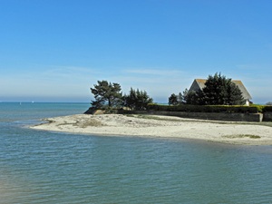
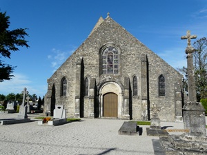
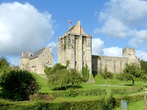
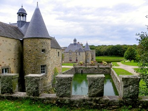
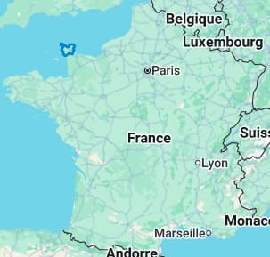
The Cotentin Peninsula, a wild promontory jutting into the Manche, is marked by striking diversity: from the vertiginous cliffs of La Hague, nicknamed "Little Ireland," to the vast sandy stretches of the east coast, and the wetlands of the Cotentin and Bessin Marshes Regional Natural Park. Naturally, the landscapes are sculpted by the winds and tides, offering protected havens of biodiversity where coastal flora flourishes between dunes and gorse heaths. The history of the Cotentin is inextricably linked to its strategic location. Its heritage is exceptionally rich, with the Vauban towers of Saint-Vaast-la-Hougue and the port of Cherbourg, home to the Cité de la Mer (City of the Sea), as its crown jewels. Between granite manor houses, Romanesque churches, and picturesque fishing ports like Barfleur, the peninsula offers a timeless escape.
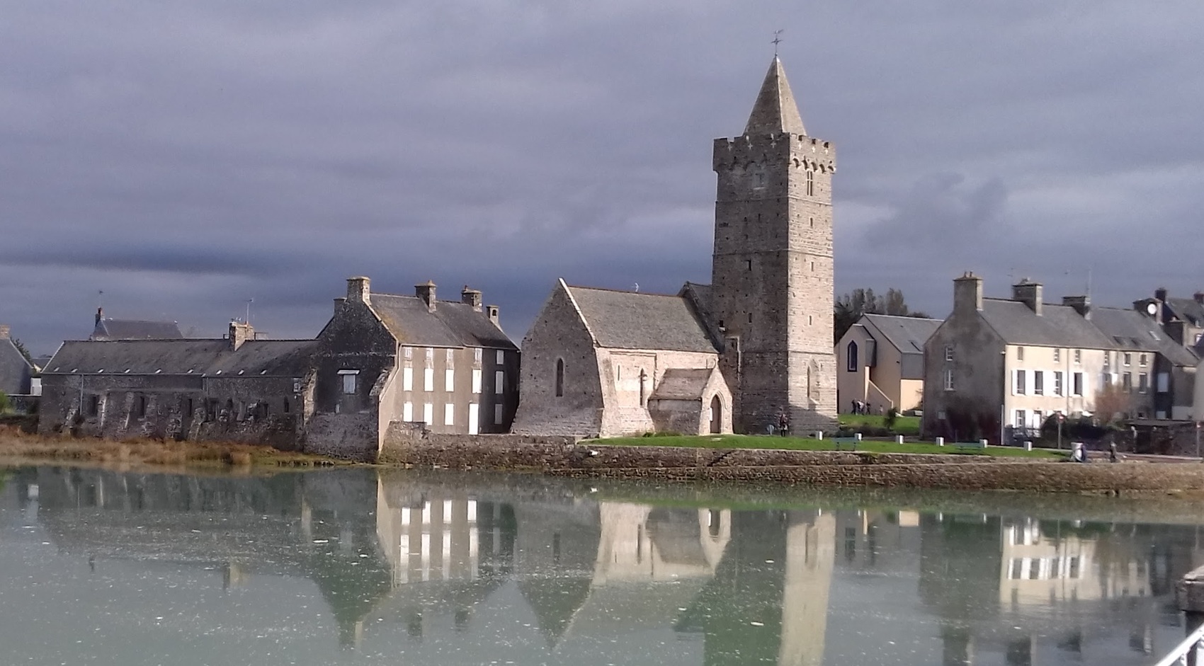
The Cotentin Peninsula alternates between the vertiginous cliffs of La Hague and the vast sandy expanses of the Cotentin Marshes Regional Natural Park. History is omnipresent, marked by the maritime epic of Cherbourg. The built heritage, with its granite manor houses and sturdy Romanesque churches, bears witness to a fierce Norman identity. Nature expresses itself with rare power, between windswept heathlands and havens where thousands of migratory birds nest. From the Genoese towers of Tatihou Island to fishing ports like Barfleur, the Cotentin offers a complete escape. It is an authentic territory, where the influence of the Gulf Stream even allows for the flourishing of surprising exotic gardens.
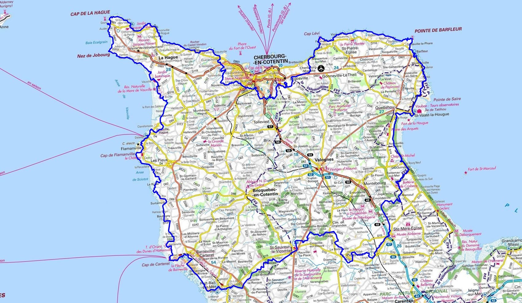
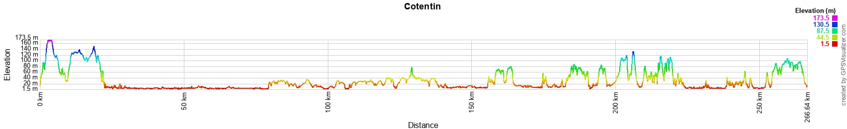
 Distance: 265km, Maximum altitude: 173m, Minimum altitude: 1m, Total ascent: 2491m
Nearby paths:
![]() It is advisable to follow the beacons all along your hike and to bring the FFRandonnée topo-guide. You will also find information on MonGR.fr.
It is advisable to follow the beacons all along your hike and to bring the FFRandonnée topo-guide. You will also find information on MonGR.fr.
GR®, PR®, GRP® and the corresponding markings are trademarks of the French Federation of Hiking. They may not be reproduced without permission. The French Federation of Hiking, state-approved, includes organizations that maintain hiking routes. It publishes guides for these routes. With your donations, support the actions of the thousands of volunteer markers of the FFRandonnée.
GR-Infos.com is an editorial partner of MonGR.fr.
| Return |

Former holiday hotel with a garden along the Allier, L'Etoile Guest House is located in La Bastide-Puylaurent between Lozere, Ardeche, and the Cevennes in the mountains of Southern France. At the crossroads of GR®7, GR®70 Stevenson Path, GR®72, GR®700 Regordane Way, GR®470 Allier River springs and gorges, GRP® Cevenol, Ardechoise Mountains, Margeride. Numerous loop trails for hiking and one-day biking excursions. Ideal for a relaxing and hiking getaway.
Copyright©gr-infos.com (Authorization for private use only)
To help us maintain and improve GR-Infos.com, a contribution of 2€ is desired via Wero or bank transfer. Thank you!