
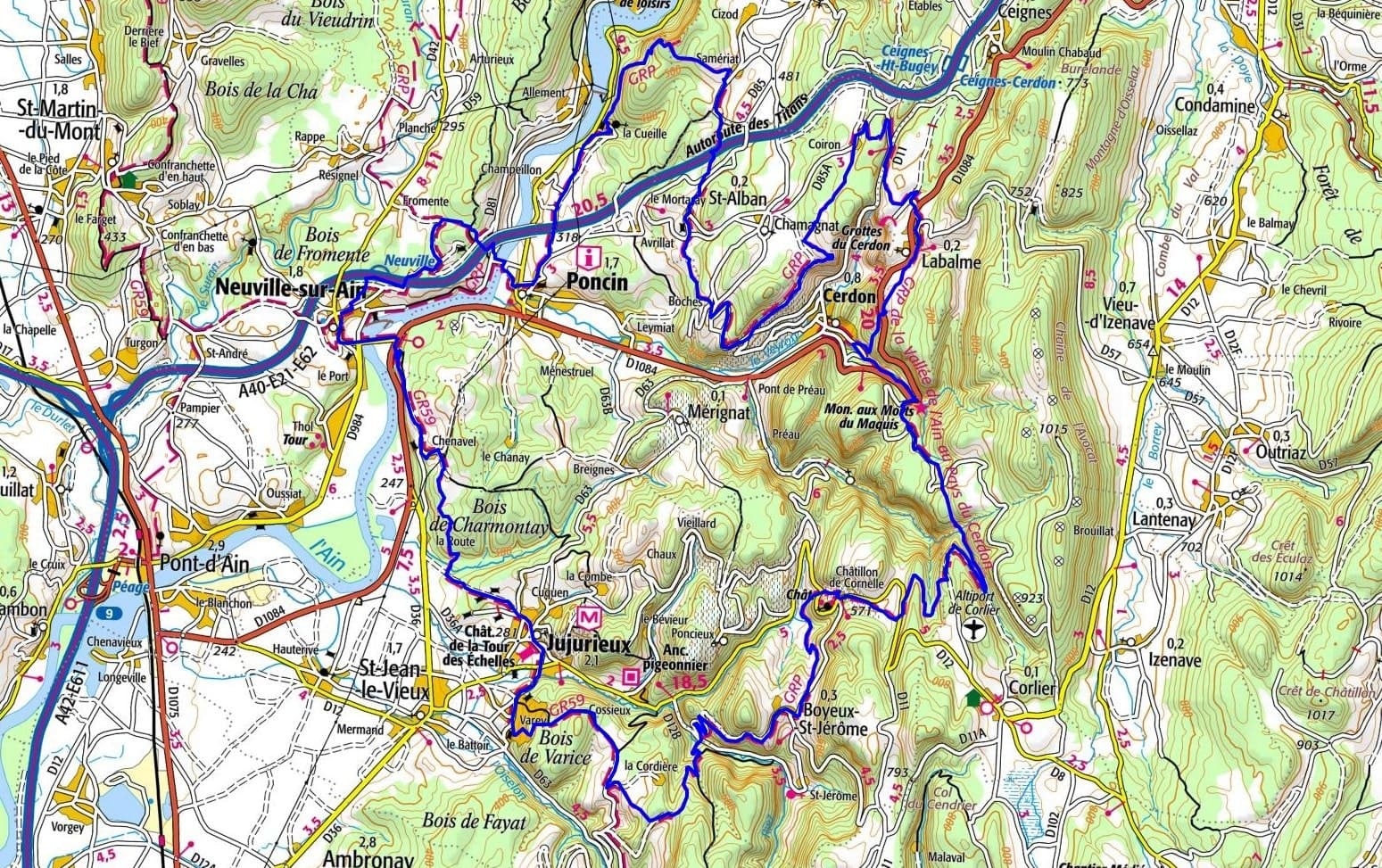
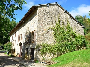
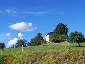
Starting from Neuville-sur-Ain, following the meanders of the Ain River towards Poncin and its Château de La Cueille, hikers discover a preserved medieval heritage nestled between terraced vineyards and limestone cliffs. The trail then ascends towards Saint-Alban and the Labalme caves, before descending to the village of Cerdon, famous for its sparkling wine and rich industrial past. The path then winds through wild, secluded valleys towards Boyeux-Saint-Jérôme, revealing unspoiled nature where dense forests alternate with panoramic views over the Ain plain. Castles abound, with the majestic silhouette of the Château de Varey, a witness to the feudal struggles of yesteryear, while Jujurieux recalls the epic story of the Bonnet silk industry. Passing through the stone hamlets of Châtillon de Cornelle and Chenavel, the route offers a sensory immersion amidst the scent of boxwood and the murmur of hidden waterfalls.
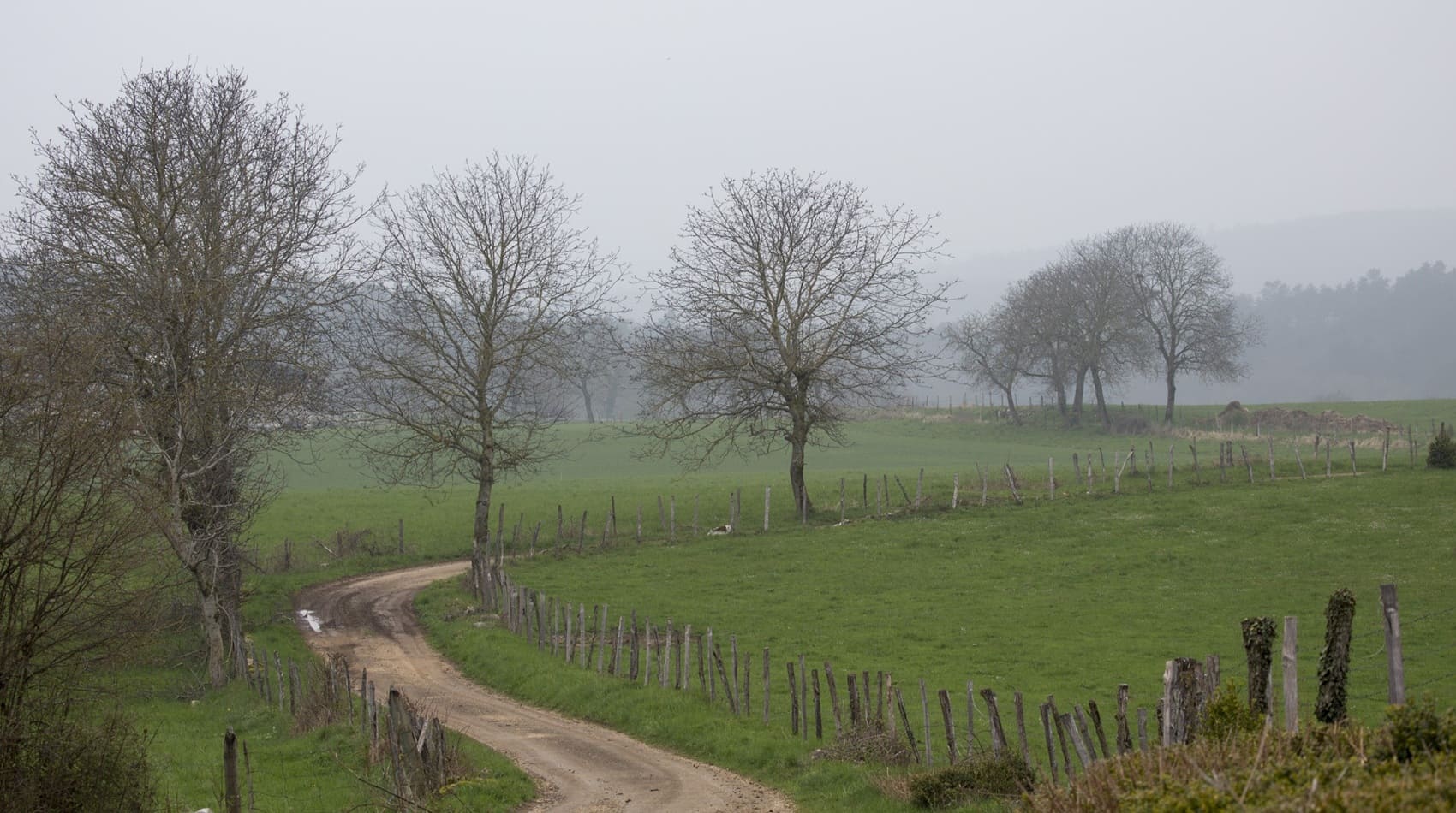
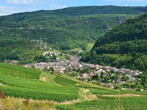
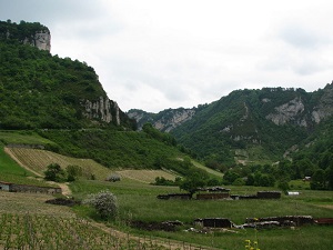
Nestled in the heart of the Ain department, the Ain Valley and the Cerdon region offer a breathtaking natural spectacle where the limestone cliffs of the Revermont meet steep vineyards. This area is inextricably linked to its winemaking heritage, famous for its sparkling rosé wine, produced using the traditional method in cellars carved directly into the rock. History is also evident in the impressive Cerdon Caves, a former prehistoric refuge now a leisure park, and the remains of Épau Abbey. The landscapes are punctuated by breathtaking viewpoints, such as the Cerdon Column, offering a sweeping view of charming villages with red-tiled roofs. As for nature, the emerald waters of the Ain River meander between wild banks, ideal for birdwatching.
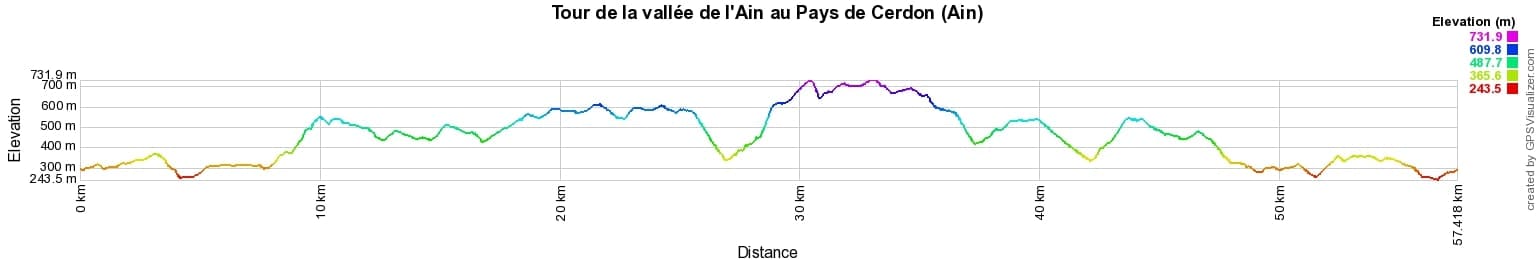
 Distance: 58km, Elevation maximum: 742m, Elevation minimum: 250m, Elevation gain uphill: 1956m
IGN Maps: Bourg-En-Bresse (Est) - 3129E. Amberieu-En-Bugey - 3130E. Nantua Hauteville-Lompnes Nord Bugey - 3230OT.
Nearby paths:
![]() It is advisable to follow the beacons all along your hike and to bring the FFRandonnée topo-guide. You will also find information on MonGR.fr.
It is advisable to follow the beacons all along your hike and to bring the FFRandonnée topo-guide. You will also find information on MonGR.fr.
GR®, PR®, GRP® and the corresponding markings are trademarks of the French Federation of Hiking. They may not be reproduced without permission. The French Federation of Hiking, state-approved, includes organizations that maintain hiking routes. It publishes guides for these routes. With your donations, support the actions of the thousands of volunteer markers of the FFRandonnée.
GR-Infos.com is an editorial partner of MonGR.fr.
| Return |

Former holiday hotel with a garden along the Allier, L'Etoile Guest House is located in La Bastide-Puylaurent between Lozere, Ardeche, and the Cevennes in the mountains of Southern France. At the crossroads of GR®7, GR®70 Stevenson Path, GR®72, GR®700 Regordane Way, GR®470 Allier River springs and gorges, GRP® Cevenol, Ardechoise Mountains, Margeride. Numerous loop trails for hiking and one-day biking excursions. Ideal for a relaxing and hiking getaway.
Copyright©gr-infos.com (Authorization for private use only)
To help us maintain and improve GR-Infos.com, a contribution of 2€ is desired via Wero or bank transfer. Thank you!