
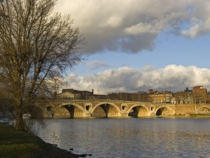
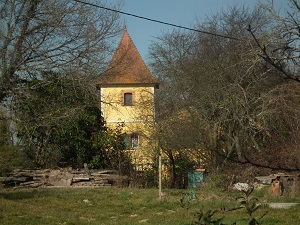
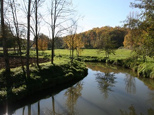
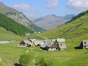
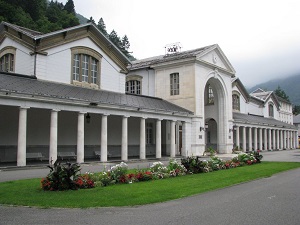
The GR®86, or Sentier des Comminges (Comminges Trail), follows the banks of the Touch River before heading into the Volvestre hills. The path winds through picturesque villages such as Saint-Bertrand-de-Comminges, renowned for its cathedral and the remains of the Gallo-Roman city of Lugdunum Convenarum. The trail offers breathtaking views of the Pyrenees, particularly from the hillsides overlooking the Garonne Valley. The flora and fauna change with altitude: the cultivated plains and oak forests of the lowlands give way to beech-fir forests and high-altitude pastures. In the wildest areas, it is not uncommon to witness the majestic flight of the bearded vulture or to encounter roe deer at the edge of the woods. The journey ends in the heart of the "Queen of the Pyrenees", Luchon, where the elegance of 19th-century thermalism is on full display.

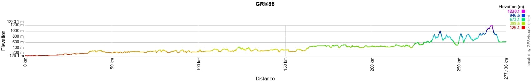
 Distance: 277km, Elevation maximum: 1224m, Elevation minimum: 130m, Elevation gain uphill: 5674m
IGN Maps: Le Fousseret (1945E). Aurignac (1945O). St-Lys (2044O). Toulouse (2143O). Montrejeau (1846E). St-Bertrand-de-Comminges (1847OT). Aurignac (1945O). Bagneres-de-Luchon Lac d'Oo (1848OT).
Nearby paths:
![]() It is advisable to follow the beacons all along your hike and to bring the FFRandonnee topo-guide. You will also find information on MonGR.fr.
It is advisable to follow the beacons all along your hike and to bring the FFRandonnee topo-guide. You will also find information on MonGR.fr.
GR®, PR®, GRP®, and the corresponding signs of markings (white/red, yellow and yellow/red) are trademarks of the French Federation of Hiking. They may not be reproduced without permission. The French Federation of Hiking, state-approved, includes organizations that create and maintain hiking routes on GR®, PR® and GRP®. It publishes guides for these topo hiking routes. With your donations, support the actions of the thousands of volunteer markers of the FFRandonnee.
GR-Infos.com is an editorial partner of MonGR.fr.
| Return |

Former holiday hotel with a garden along the Allier, L'Etoile Guest House is located in La Bastide-Puylaurent between Lozere, Ardeche, and the Cevennes in the mountains of Southern France. At the crossroads of GR®7, GR®70 Stevenson Path, GR®72, GR®700 Regordane Way, GR®470 Allier River springs and gorges, GRP® Cevenol, Ardechoise Mountains, Margeride. Numerous loop trails for hiking and one-day biking excursions. Ideal for a relaxing and hiking getaway.
Copyright©gr-infos.com (Authorization for private use only)
To help us maintain and improve GR-Infos.com, a contribution of 2€ is desired via Wero or bank transfer. Thank you!