|
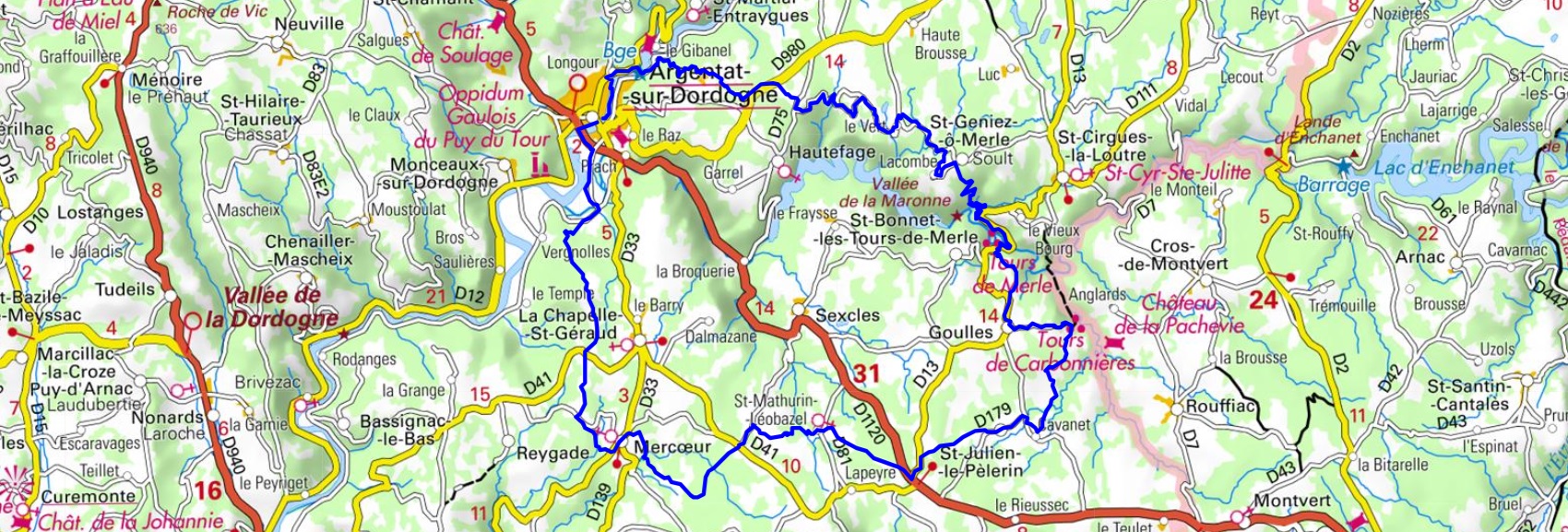
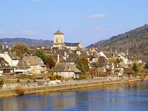
Hike in Correze department around Xaintrie Noire from Argentat-sur-Dordogne via le Barrage du Sablier, Combe Lescure, Le Fournel, Saint-Geniez-o-Merle, Goulles, Auyeres, Saint-Julien-le-Pelerin, Saint-Mathurin-Leobazel, Mercour, Combalier and Le Chambon. Guest House, Bed and Breakfast, Hotel, Camping, Shelter, Inn, Shops.
|

|

Around Xaintrie Noire (Correze)
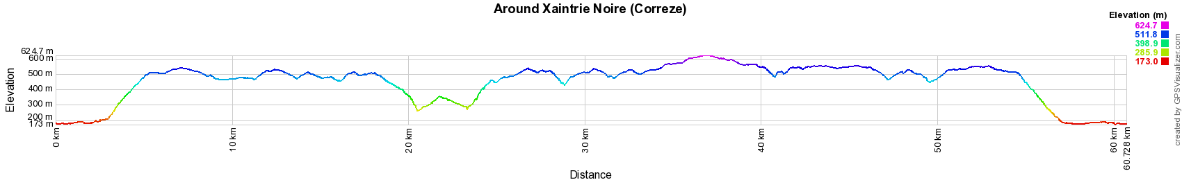
61km
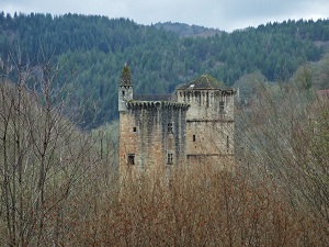
Xaintrie Noire is a natural region delimited by the Maronne, Cère and Dordogne rivers. Xaintrie Noire is characterized by a rugged terrain, with granite plateaus cut by deep gorges. The soils are poor and acidic, which explains the presence of a dense forest, composed mainly of oaks, beeches and chestnut trees. The history of Xaintrie Noire dates back to prehistoric times. It was inhabited by the Gauls, the Romans and the Visigoths. During the Middle Ages, the region was an important center of wool and leather production.
Google Maps - Google Earth

© GPX Private use only |
Distance: 61km, Elevation maximum: 631m, Elevation minimum: 175m, Elevation gain uphill: 1533m
IGN Maps: Saint-Privat Barrage de Chastang - 2235E. Argentat - 2235O.

Registration
Accommodation or business owner on or near a GR®, you can appear on GR-INFOS
For your registration, you can send me by email (papadimitriou4@gmail.com): your address and phone number, your website (Facebook page), a brief description with 5 beautiful photos of your establishment.
Registration price : € 100 per GR® or GRP® for 5 years. Renewable. |
Nearby paths:
Around Sumene Artense (Cantal, Correze, Puy-de-Dome)
Around Midi Correzien (Correze)
Around Gabariers (Correze)
Between Dordogne and Ventadour (Correze)
Around Millevaches plateau (Correze)
Around Vezere Gorges (Correze)
Around Xaintrie Blanche (Correze)
GR®440 Around Limousine mountain (Correze, Haute-Vienne, Creuse)
GR®480 From Turenne to Cere Gorges (Correze)
GR®652 Rocamadour way
 It is advisable to follow the beacons all along your hike and to bring you the FFRandonnee topo-guide. You
will also find information on MonGR.fr.
It is advisable to follow the beacons all along your hike and to bring you the FFRandonnee topo-guide. You
will also find information on MonGR.fr.
GR®, PR®, GRP®, and the corresponding signs of markings (white / red, yellow and yellow / red) are trademarks of the French
Federation of Hiking. They may not be reproduced without permission. The French Federation of Hiking, state-approved, includes organizations that create and maintain hiking routes on GR®, PR® and
GRP®. It publishes guides these topo hiking routes.
With your donations, support the actions of the thousands of volunteer markers of the FFRandonnee.
GR-Infos.com is an editorial partner of MonGR.fr.
Old romantic Hotel, L'Etoile Guest-House is a mountain retreat in the South of France. With a beautiful park along the Allier River, L'Etoile Guesthouse is located in La Bastide-Puylaurent between Lozere, Ardeche and Cevennes. Many hiking trails like GR®7, GR®70 Stevenson trail, GR®72, GR®700 Regordane way, Cevenol, GR®470 Allier River Springs and Gorges, Margeride, Ardechoise. Many hiking loops. The right place to relax.
Copyright©gr-infos.com (Authorization for private use only)