|
GR®58
Around Queyras (Hautes-Alpes)
|

|
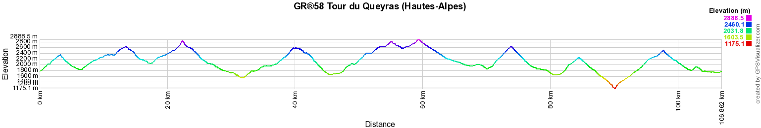
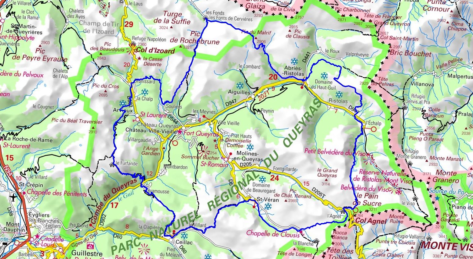
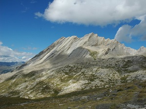
The GR®58, also known as the Tour du Queyras, is a long-distance hiking trail that meanders through the stunning landscapes of the Hautes-Alpes. Spanning approximately 107 kilometers, this route offers a complete immersion in the pristine nature of the Queyras Regional Natural Park. Starting from Arvieux, this journey takes you through charming villages such as Les Vastres, Abriès-Ristolas, Saint-Véran and Ceillac.

Google Maps - Google Earth

© GPX Private use only |
Distance: 107km, Elevation maximum: 2888m, Elevation minimum: 1175m, Elevation gain uphill: 7674m
IGN Maps: Guillestre Vars Risoul PNR du Queyras (3537ET). Mont Viso St-Veran Aiguilles PNR du Queyras (3637OT). Haut Queyras - Mont
Viso (ASF8).
***
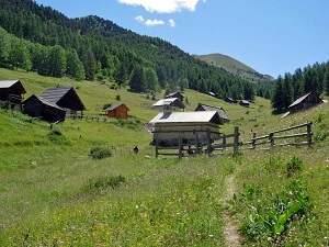
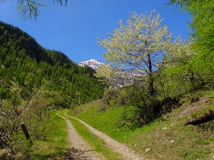
The journey begins in Arvieux, a charming village nestled in the heart of the valley, surrounded by majestic mountains. Hikers can admire the traditional stone and wooden houses, as well as the verdant landscapes that stretch as far as the eye can see. The path then leads to Les Vastres and onward to Abriès-Ristolas, a crucial stage of the GR®58. This village is renowned for its exceptional biodiversity, where walkers can observe a variety of fauna, ranging from marmots to chamois, alongside rich and colorful flora.
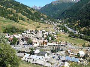
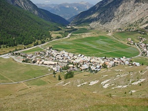
The trail continues towards Saint-Véran, the highest village in Europe, perched at an altitude of 2042 meters. This authentic village is famous for its wooden houses and slate roofs. Hikers can discover a unique cultural heritage here, with ancient churches and museums tracing the local history. Finally, the GR®58 leads to Ceillac, a picturesque village nestled in a lush valley.
Registration
Accommodation or business owner on or near a GR®, you can appear on GR-INFOS
For your registration, you can send me by email (papadimitriou4@gmail.com): your address and phone number, your website (Facebook page), a brief description with 5 beautiful photos of your establishment.
Registration price : 50€/2 years or 100€/5 years per GR® or GRP®. Renewable. |
Nearby paths:
GR®5 From Luxembourg to Mediterranean sea
GR®5C From Nevache to Briançon (Hautes-Alpes)
GR®50 Around Ecrins National Park (Hautes-Alpes, Isere)
GR®54 Around Oisans and Ecrins Massifs (Isere, Hautes-Alpes)
GR®56 Around Ubaye (Alpes-de-Haute-Provence, Alpes-Maritimes)
GR®69 La Routo
GR®653D Via Domitia
 It is advisable to follow the beacons all along your hike and to bring you the FFRandonnee topo-guide. You
will also find information on MonGR.fr.
It is advisable to follow the beacons all along your hike and to bring you the FFRandonnee topo-guide. You
will also find information on MonGR.fr.
GR®, PR®, GRP®, and the corresponding signs of markings (white / red, yellow and yellow / red) are trademarks of the French
Federation of Hiking. They may not be reproduced without permission. The French Federation of Hiking, state-approved, includes organizations that create and maintain hiking routes on GR®, PR® and
GRP®. It publishes guides these topo hiking routes.
With your donations, support the actions of the thousands of volunteer markers of the FFRandonnee.
GR-Infos.com is an editorial partner of MonGR.fr.

Former holiday hotel with a garden along the Allier, L'Etoile Guest House is located in La Bastide-Puylaurent between Lozere, Ardeche, and the Cevennes in the mountains of Southern France. At the crossroads of GR®7, GR®70 Stevenson Path, GR®72, GR®700 Regordane Way, GR®470 Allier River springs and gorges, GRP® Cevenol, Ardechoise Mountains, Margeride. Numerous loop trails for hiking and one-day biking excursions. Ideal for a relaxing and hiking getaway.
Copyright©gr-infos.com (Authorization for private use only)